Bradley Shellito @GeoBradShellito
Professor at Youngstown State University. Teaches GIS and remote sensing. Author of 'Discovering GIS and ArcGIS' and 'Introduction to Geospatial Technologies.' Joined November 2014-
Tweets278
-
Followers94
-
Following120
-
Likes42
A graduate student (Jen L.) from a remote sensing course just shared this screenshot from "X-Files." Now I know that I am in the wrong business.....


What's new with Scene Layers in ArcGIS Pro 2.3 p.ctx.ly/r/94rf

The ArcGIS Pro Roadmap has been updated! Check out some of what we're working on for the next few releases. p.ctx.ly/r/945o


The castle where King John stayed before signing the Magna Carta. trib.al/R8Z9Hoi
The Land of Make-Believe is closer than you might think. Part of it's in the Land of Pittsburgh. trib.al/JKq7jf5
It's a new twist on pretzel twists. trib.al/EdmpPMW

Welcome to the team, #ICEsat2! We can’t wait to see your science. 💚

I had the privilege of seeing the @sensefly eBee X in action. IMPRESSIVE The future of fixed-wing #3D #drone mapping is here! Nice work @Parrot youtube.com/watch?v=jxriE8…
Looking ahead to the launch 🚀 of #ICESat2 on Sept. 15 with #10Things you need to know about NASA’s latest space laser. ❄️ 🛰 go.nasa.gov/2Mi9yCz

This really is a cool map! An interactive guide to the 2018 Winter Olympics using @Esri : coolmaps.esri.com/Olympics/2018/


Can you use @Esri @ArcGISApps for #Geocaching? Why not! ow.ly/ziPk30hYvxp @EsriPartnerNet @SSPInnovations


Dynamically calculate distances in Scene Viewer as you move over features, terrain, buildings or point clouds in your scenes. With just one action, you can measure the direct, horizontal and vertical distances: p.ctx.ly/r/6eeu

Local #SiouxFalls #STEM / #STEAM outreach and education using #RemoteSensing using @AmericaView @USGS @NASA #EarthObservationDay posters and #Landsat image puzzles developed by #LouisanaView!


#LandsatARD consists of: Top of atmosphere (TA) reflectance Brightness temperature (BT) Surface reflectance (SR) Pixel quality assessment (QA) landsat.usgs.gov/ard #Pecora20


Top story: 75 Years of CIA Maps Now Declassified & Made Available Online | Ope… openculture.com/2016/12/see-75…, see more tweetedtimes.com/v/1527?s=tnp
We mapped tree canopy change in Baltimore at the individual tree level w/@UrbanMGrove @DextraordinaryH @MFGalvin @usfs_nrs

IGT 4th edition also features a fully revised chapter on studying Earth's climate and environment from space using remote sensing
IGT 4th edition also has expanded sections on sUAS, commercial remote sensing satellites, cubesats, geodatabases, GNSS, and a lot more
Other software used in IGT 4th edition: Google Earth Pro, the new browser Google Earth, Multispec, ArcGIS Online, and MapTiler

Angel Paredes @Almauri99
43 Followers 682 Following
Bob Harrison @bharrisonEDU
722 Followers 3K Following K-12 Curriculum Teacher Leader. Learning, Innovation, and Technology Consultant. Always a teacher. People first. Teachers are my heroes. Views are my own.
شوق الرهف @tmgrimme
7 Followers 132 Following
Shannonsmz @shannonsmz
48 Followers 99 Following A candle loses nothing by lighting another candle 💞
Timothy L. Hawthorne @timlhawthorne
2K Followers 2K Following Chair & Full Professor of Geosciences at Auburn University 🦅 | 2024 National Geographic Explorer 🌏 | Science on Wheels Enthusiast | GeoBus Founder 🚌
Darien Shinniman @ShinnimanDarien
52 Followers 175 Following Queen’s University ‘25 - Future Teacher 👨🏫 - Emergency Occasional Teacher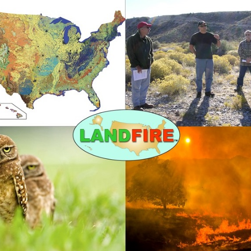
LANDFIRE @nature_LANDFIRE
4K Followers 3K Following LANDFIRE | National geospatial layers | Vegetation models for all major systems in U.S. | Product support | Supports land management
Nathan Hepburn @Nate_andApen
10 Followers 175 Following
Muse and Metrics @museandmetrics
114 Followers 177 Following Muse and Metrics is content and conversations about aligning the possible with the practical. Weekly radio show on 360 Talk Radio for Women on Monday at 10am ET
Santhosh M @santhosh_m31
263 Followers 1K Following I'm data scientist, trying to be somehow useful in tracking 🌴🔥🌧🌊. pastime activities : play chess ♟, biking 🚴 and plane spotting 🛩.
Michael The Lion @djaptone
2K Followers 2K Following Producer + DJ / City Planner + Assoc. Prof @WeitzmanSchool @pennmusa. Nighttime culture advocate. Music - Soul Clap / Razor-N-Tape / Defected.

Excavation Safety All... @JoinESAlliance
1K Followers 1K Following Excavation Safety Alliance (ESA) believes there's safety in numbers, safety in education, and safety in collaboration.
Jun han @Johngz08
20 Followers 4K Following

Thomas Craig, PhD @thomasrcraig
127 Followers 394 Following A Trifecta: Husband, Father, & Geographer. Tweets my own.
Luis Bentancor Bossio @Luis20534442
64 Followers 522 Following PhD. student in the Geospatial Laboratory for Soil Informatics at Iowa State University
Jordan Brasher @jpbrasher
2K Followers 4K Following Recovering academic | Displaced Southerner | Map fiend | Trying to be less online | #GBO🍊 | he/they | Tweets are my own
Christopher McGinty @cmcginty
811 Followers 866 Following Geospatial scientist in ecology, remote sensing, Landsat, UAS, beekeeper, backcountry skier, outdoor explorer. Executive Director at AmericaView.
@[email protected]... @gisdaveparr
308 Followers 877 Following Coffee lover, Teaching Assistant Professor of Spatial Data Science at @geographyunc
Amanda Suzzi, PhD (sh... @funkepunkemonke
427 Followers 841 Following 🌍 Geospatial Technology and 🐵 Ecology Instructor by day, even bigger nerd by night 🛼#rollerderby 🏳️🌈 #queerinSTEM 🎓#firstgen
Jhanté King @JhanteKing
6 Followers 44 Following Biocultural Anthropology undergraduate student at Oregon State University. Finding a path among researchers while raising a family!
Timothy LeDoux @TimothyLeDoux
399 Followers 1K Following Professor / Geography, Planning & Sustainability / Westfield State University / Anti-Hunger & Poverty / food systems / Detroit / GIS
Qiusheng Wu @giswqs
46K Followers 4K Following Associate Professor @UTKGeography | @Amazon Scholar | Talk about #opensource #geospatial #dataviz #EarthEngine
Rachel Faerber-Ovaska @RFaerberovaska
162 Followers 1K Following A 🐈 may look at a king. Work: Languages, research, learning design & #DigitalPedagogy. EdD in Language, Literacy, & Culture.
Brooke @brookemadeulook
38 Followers 154 Following bobby’s mom and former TV news junkie, who now peddles printed words and enjoys the taste of straight tequila over ice with 3 limes
Sarahi Amaya @sarahii07
32 Followers 434 Following

That Spatial Tech Guy... @MappingIt
2K Followers 2K Following Spatial Tech Evangelist. Finding the latest in X, Y, Z, & T. Leader, mentor, innovator, farmer. Helping map a smarter 🌎 one day at a time! #GIS #UAS #AR #AI
Diana Palardy @DianaPalardy
169 Followers 260 Following I am a Spanish professor at Youngstown State University specializing in Spanish dystopias. I recently published a book on the topic. Budding interest in DH.
Scott Lussier @snlussier
232 Followers 787 Following Digital Mapping Expert and University Instructor | Currently teaching FOSS Geospatial Data Analysis, Mapping and Drone skills to as many people as I can.


Jessica McCarty @jmccarty_geo
20K Followers 3K Following Personal account, don’t speak for employer not official NASA comms. I post🔥-food-climate- 🛰 science. ❤️s 🔁s not endorsements. She/her/Kentucky Hillbilly
Space Waif @waif_space
1K Followers 4K Following
The Game Steward @TheGameSteward
288 Followers 356 Following TheGameSteward is an online #gamestore specializing in #Kickstartergames at reasonable prices. Also offering out of print & imported games. It's time to play!
Geophysics 2017 @Geophysics2017
211 Followers 1K Following Conferenceseries LLC all the participants across the globe to attend the "2nd International Convention on Geophysics and Geotechnics" during November 8-9, 2017
YSU Faculty @YSUFaculty
496 Followers 467 Following Official website: https://t.co/lYXgMh7dxe Media website: https://t.co/ysl4c9u5sH Spokesperson: Dr. Mark Vopat, [email protected] #StudentsFirstYSU

The American Geograph... @AmericanGeo
12K Followers 3K Following The first national geographical organization in the United States. Nonprofit organization spreading geographical and geospatial awareness since 1851.
Moinuddin Farooqui @mfarooqui73
111 Followers 291 Following GIS Specialist, specialized in vector data development and management. Cartography is my passion.
gWorks @gWorksTech
121 Followers 146 Following gWorks delivers a Simple Software Suite to empower local public leaders to build a Smarter Government and a Stronger Community.
ARK - Access Research... @ArkGroupCo
530 Followers 1K Following ARK group is the leading scientific networking website, offering top scientific trending information and foremost events and webinars.

Emily A. Fogarty @boneyardrat
154 Followers 468 Following Geospatial Scientist-Heavy metal fiend & loyal Fanther! - Avid singer -420- Need more tattoos – Racing junky – have ten familiars-meow :)
Bradley Miller @geograph_miller
308 Followers 185 Following an agronomist (more specifically a soil geographer) at Iowa State University
ArcGis Lessons @ArcGisLessons
603 Followers 4K Following

GPN VC (URISA) @URISAVC
2K Followers 3K Following GPN's Vanguard Cabinet: Opportunities, Leadership, and Advice for Young & Emerging GIS Professionals & GIS Students! #GIS #Geospatial #YP @URISA

Google AR & VR @GoogleARVR
148K Followers 105 Following Years of AR/VR innovation continue on @AndroidDev! Join us there for all future #AndroidXR adventures.
Jessica McCarty @jmccarty_geo
20K Followers 3K Following Personal account, don’t speak for employer not official NASA comms. I post🔥-food-climate- 🛰 science. ❤️s 🔁s not endorsements. She/her/Kentucky Hillbilly
CARTO @CARTO
31K Followers 6K Following Spatial analytics built for the cloud. Sign up for your free 2-week trial: https://t.co/K3o3gkbN5l
DJI @DJIGlobal
1.3M Followers 842 Following Official Twitter feed of DJI, the world leader in aerial and handheld cinematic solutions. Contact @DJISupport for customer support.
senseFly, now AgEagle @sensefly
16K Followers 366 Following We are now @AgEagleUAVS, provider of professional solutions in drones, sensors and software. Follow us there.
Eagleview @EagleViewTech
6K Followers 3K Following Eagleview is a leading provider of aerial imagery, property insights and software that transforms the way people work.
pix4d @pix4d
21K Followers 1K Following Professional photogrammetry software for mobile and drone mapping. https://t.co/i7a8nuzrYZ
SMOS satellite @SMOS_satellite
843 Followers 223 Following Soil Moisture and Ocean Salinity is an @ESA mission with @CNES and @CDTIoficial. @CesbioLab proposed SMOS, hosts the SMOS PI and is Expert Support Lab for @ESA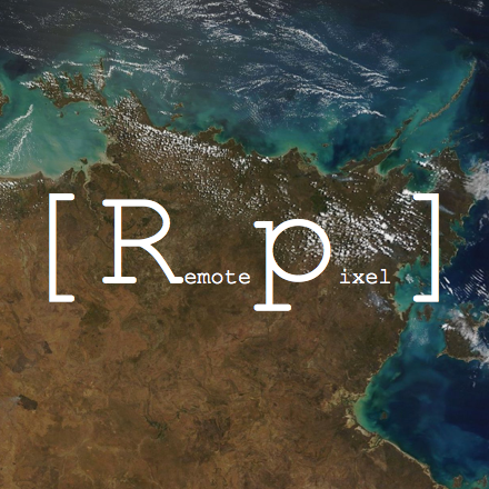
Remote Pixel @RemotePixel
3K Followers 84 Following Making Earth Observation available to everyone #Landsat #MODIS #VIIRS #Sentinel #Webmapping #OpenData
Monde Geospatial @MondeGeospatial
11K Followers 3K Following Geospatial videos, news, articles and events relating to #GIS, #cartography, #RemoteSensing, #GPS, #Surveying, #Geomatics and #geospatial technologies
ArcGIS Apps @ArcGISApps
17K Followers 268 Following On your desktop, mobile device, or browser, ArcGIS Apps are a collection of integrated, location-based apps that work wherever you do. Brought to you by @Esri.
Trimble GIS @trimblegis
4K Followers 26 Following Trimble GIS Data Collection is the leading provider of advanced positioning solutions for GIS applications.
Umesh Haritashya @GlacierResearch
702 Followers 464 Following Professor & Mann Chair @univofdayton. Cryosphere research - Satellite, Machine Learning, Modeling, Hydrology, Hazards, Geomorphology. @TEDxDayton 2021 speaker.

NACIS @NACIS
8K Followers 430 Following Do you #lovemaps? The North American Cartographic Information Society has been the home for map enthusiasts since 1980. Learn more at https://t.co/Hv52ISpktf!
Mapzen @mapzen
6K Followers 215 Following Open, sustainable, and accessible mapping tools. We build things so you can build things. Now a Linux Foundation project!Roadside America @RoadsideAmerica
7K Followers 102 Following Guide to 16,000+ offbeat tourist attractions. Road trip tales, tools, website, books, GPS, mobile apps.
Roadtrippers @Roadtrippers
30K Followers 2K Following Helping travelers plan the most epic road trips.
OpenStreetMap US @OpenStreetMapUS
6K Followers 1K Following OpenStreetMap US is a nonprofit working to grow & support OpenStreetMap in the U.S. by connecting & convening community. *@[email protected]*
LANDFIRE @nature_LANDFIRE
4K Followers 3K Following LANDFIRE | National geospatial layers | Vegetation models for all major systems in U.S. | Product support | Supports land management
NASA Goddard Images @NASAGoddardPix
413K Followers 980 Following We share cool science! This is the official image/video tweeting account for @NASAGoddard.
Google Earth Outreach @EarthOutreach
195K Followers 1K Following We’ve decided to close this channel to better focus on our on our other online communities. You can still follow along at @GoogleEarth
New MexicoView @NewMexicoView
128 Followers 978 Following NMView is the New Mexico component of the AmericaView consortium. https://t.co/D3cjFMLnxw
Emily @wildlifegisgirl
3K Followers 3K Following map nerd, data wrangler, conservation advocate #spatial #technology #tech4wildlife #gistribe #gischat #bigcats *All posts are my own
GeoMeetup @geomeetup
3K Followers 3K Following GeoMeetup is a vibrant event-organizing and networking group focused on geospatial technology
Seth Dixon @ProfessorDixon
4K Followers 607 Following Geography educator. Former Chief Reader for #APHG @APHumanGeog and am enjoying time in Rhode Island.GPS Business News @gpsbusinessnews
13K Followers 1K Following GPS Business News is an online media providing business insights on mass market Geolocation applications for cars, smartphones and consumer electronics.

OhioView @OHViewGeo
18 Followers 23 Following We are the statewide geospatial and remote sensing research and education consortium of Ohio. We're one of the many members of @AmericaView.
Bern Szukalski @bernszukalski
5K Followers 216 Following GIS technical evangelist and geo advocate, product strategist. On a good day I'm making a map. On a great day I'm on one.
Karen Richardson @mudmo
3K Followers 2K Following Senior Partner Dev Manager @ Microsoft. Tweets are my own.
Esri Training @EsriTraining
35K Followers 1K Following Advancing geospatial capabilities of individuals, teams, and organizations is our mission and our passion.
USGS Energy Program @usgsenergy
12K Followers 21 Following This is an archived account and is not being updated. For the latest updates follow @USGS.
Geography @MSU @GEOatMSU
1K Followers 208 Following Official site for the Department of Geography, Environment, & Spatial Sciences at Michigan State University (@michiganstateu).
Online Geography@MSU @onGEOatMSU
537 Followers 82 Following Undergrad, grad, and professional courses offered online by the Dept of Geography, Environment, & Spatial Sciences (@GEOatMSU) at MSU (@michiganstateu).
Leaflet @LeafletJS
29K Followers 1K Following Leaflet, an open-source JavaScript library for mobile-friendly interactive maps 🍃🇺🇦
Mapbox @Mapbox
75K Followers 2K Following Mapbox powers navigation for people, packages, and vehicles everywhere. Register for BUILD with Mapbox.
Esri Public Safety @GISPublicSafety
11K Followers 4K Following Discover the power of ArcGIS to manage emergencies and the flow of public information.
waze @waze
253K Followers 332 Following Install Waze for free today at https://t.co/aw44bXjoX4. Share how you've outsmarted traffic with #WazeWin on social media & we'll share our favorites.
Esri Disaster Respons... @EsriDRP
4K Followers 202 Following Esri's DRP assists with disasters worldwide. We support response and relief efforts with GIS technology and expertise when your capacity is exceeded.
Geospatial Solutions @GSS_NCM
2K Followers 387 Following
Slashgeo @slashgeo
553 Followers 126 Following Manually selected geospatial news. Slashgeo .org itself has been closed. Enjoy -- Alex / Satri
🇪🇺 EUSPA - EU A... @EU4Space
19K Followers 913 Following EUSPA provides safe & performant #EUSpace Services, linking @CopernicusEU, EGNSS & SATCOM to EU citizens, and operates the @EU_SST Front Desk.
Christopher McGinty @cmcginty
811 Followers 866 Following Geospatial scientist in ecology, remote sensing, Landsat, UAS, beekeeper, backcountry skier, outdoor explorer. Executive Director at AmericaView.
Skydio @SkydioHQ
22K Followers 487 Following Skydio is the leading U.S. drone manufacturer and world leader in autonomous flight.
NASA OCO-2 @IamOCO2
12K Followers 33 Following Orbiting Carbon Observatory-2 launched July 2, 2014. This account is no longer active.
@claireburwell @claireburwell
250 Followers 711 Following Dr. in geography 🌍 who works in 🇫🇷 #HigherEd and loves science communication 🔬🎨📢 / teaching & education 👩🏫 / maps 🗺️ / illustration ✍️ / britpop 🇬🇧
NASAEarthdata @NASAEarthData
40K Followers 382 Following This account is inactive. Follow @NASAEarth and subscribe to our newsletter for data releases and other Earthdata news: https://t.co/pOtbqt9QpY
Steven Rigolosi @srigolosi
189 Followers 294 Following Novelist. Full-time editor, part-time flutist, devoted reader. THE HAUNTING OF KINNAWE HOUSE now available. Pls. contact me for review copy!
UN-SPIDER @UN_SPIDER
10K Followers 1K Following United Nations Platform for Space-based Information for Disaster Management and Emergency Response http://t.co/f6tIBN4y (Programme of @UNOOSA)Trends for United States
You might like