gomapping @GoMapping
Custom GIS & Close Range Photogrammetry gomapping.ca Grande Prairie, AB, Canada Joined August 2014-
Tweets217
-
Followers168
-
Following386
-
Likes18
Watching @smathermather 'droning' on at #sotmafrica. #drones #runrobotsrun
Free online magazine for UAV enthusiasts droneuser.co.uk #uav #drone
Interesting #RemoteSensing break through by @Carbomap. Advanced #LiDAR on Fixed-Wing #UAV. Good #forestry potential carbomap.com/2017/07/07/fir…
CompassDrone to roll out DJI2FMV App bit.ly/2tJOGim at #EsriIMF and #EsriUC booth 2218 mapping grade full motion video in ArcGIS
Checkout @Esri's new #imagery and remote sensing site esri.com/arcgis/imagery… #esri #arcgis #GIS #mapping @ArcGISPro @ArcGISanalysis
The #GeoNB lidar download map has been updated #OpenData geonb.snb.ca/li/index.html
We’ve added more @planetlabs data at Open Data Areas Alberta. Visit opendataareas.ca for this and other no-cost datasets. #opendata
#geomatics article: Interview with Ted Mackinnon: Promoting Canadian GIS & Geomatics on Twitter ow.ly/QG6A508etlE
Worth a look...openforis.org #opendata #forestry
The kind of news I like to see #opendata
@DJIGlobal has officially entered into the aerial inspection business with this 30X optical zoom camera. ow.ly/JJCX305yIBn
New blog up at elevatedrs.com/blog/. All about how drones are helping shape road design in the Caribbean. How have you been using drones?
For everyone flying a drone recreationally, or getting one for christmas, read this! ow.ly/4bcF305kM1S
Do you like the enviornment? check out this page from @sensefly . Great information and case studies. ow.ly/MKKB305iuum
#TBT to some amazing times flying the @sensefly eBee in the winter (It was warm this day)! Winter flying? read this ow.ly/JKuZ305nkl8
flying a drone for fun? or getting one for christmas, read this! ow.ly/4bcF305kM1S
Drone tip #2. DO NOT FLY IN RAIN, unless your drone looks like this. Even then, your images will not turn out, so is it worth it?
October is for safety and cold weather flying tips. Check out this article from @DJIGlobal on cold weather tips ow.ly/PmEZ304KVx7

Caleb Ullrich @CalebUllri31247
65 Followers 4K Following
Robert Coutts @bwthaiawdik
46 Followers 106 Following Owner of SkyBase Solutions ... featuring PatchMap, the flagship navigational tool for the Canadian Oilfield. [email protected] 780-518-2666
Scot Wiley @Scot_Wiley
4 Followers 142 Following
Cliff Patterson, Ph.D... @cliffpat
2K Followers 2K Following CEO of @LunaGeospatial, husband, father, and supporter of all things open source #GIS. #QGIS #postgis #osgeo All opinions are my own.
Modern Hiker @modernhiker_
171 Followers 1K Following
ChoiceSurveySupplies @ChoiceSupplies
363 Followers 828 Following Proudly serving #Alberta and Western @Canada a vast selection of surveyor & #construction supplies with top notch customer service! We ship anywhere!
Tarin Resources @TarinResources
189 Followers 834 Following Geospatial Hub - Reliable Data. Trustworthy Connections. Making geospatial data discoverable, accessible & usable.
GIS Resumes @GISResumes
310 Followers 2K Following Creating your effective #resume to help you land your dream #GIS job! Contact us for a free resume review!
Drones for Agricultur... @UAV4Ag
43K Followers 4K Following Promoting responsible use of unmanned aerial systems #UAS in #farming #fisheries #livestock | #PrecisionAg #UAV #sUAS #RPAS #agriculture #DataScience
Mapsense Geospatial @mapsensegeo
59 Followers 127 Following We provide comprehensive Surveying, Mapping & GIS services to a variety of clients, including property owners, law firms, Govt agencies, businesses and realtors
Steve Snow @steve_snow_
4K Followers 4K Following #EsriUC Fan of GIS and Charting, ex Army Enlisted and Officer, NOAA Officer, Surveyor (Hydro, Land, Air), and most important Husband Father. #GIS #Geospatial
GIS and Science @GISandScience
30K Followers 10K Following Sharing issues and applications of geospatial technology for scientific research and understanding. Tweets by the @Esri Science Team with @deepseadawn
Emma Beauchamp @EmmaBeauchamp6
2 Followers 50 Following
GeoAlberta @GeoAlberta
696 Followers 451 Following GeoAlberta is a collaborative effort of URISA Alberta, Alberta Geomatics Group (AGG), and GeoEdmonton. Together we host an annual Conference bringing together
Princes of Pilbarra @PilbarraPrinces
168 Followers 2K Following Princes of Pilbarra: Guarding the Gardens is a beautifully illustrated 48-page picture book full of quirky characters, and kid-friendly science.
Hans Wennberg @Grelsbyn
5 Followers 77 Following
Drone and Quadcopter @DroneAndQuad
2K Followers 2K Following We bring you the latest drone and quadcopter news and information at http://t.co/S3I6r8WfkJ
GeoTagMyPhoto.com @GeoTagMyPhoto
238 Followers 2K Following #Geotag your #photos in 3 simple steps: 1) upload photo 2) select #location on a #Googlemap 3) download #geotagged photo. #FREE
Unmanned World @UnmannedWorld
3K Followers 2K Following UNMANNED WORLD, all things Unmanned Vehicles and Robotics #drones #UAV
Richard Dos Santos @rich3759
3K Followers 2K Following My mission is to travel the country with my drone and get everything on video. You can find most of my videos on my YouTube channel. #drone #dji #uav #fpv
GPN VC (URISA) @URISAVC
2K Followers 3K Following GPN's Vanguard Cabinet: Opportunities, Leadership, and Advice for Young & Emerging GIS Professionals & GIS Students! #GIS #Geospatial #YP @URISA
郭 @guojuwei1
6 Followers 89 Following
QuestUAV Ltd @QuestUAV
5K Followers 2K Following QuestUAV - We are a British manufacturer of UAS. Our fixed wing UAS are used for land surveys, mining and agricultural applications.
Cody Skye @b2e1442cc349482
7 Followers 76 Following
SABRE ADVANCED 3D @SabreSurvey
3K Followers 4K Following SABRE ADVANCED 3D, design, develop and manufacture standalone and fully integrated mobile 3D Geospatial data acquisition product solutions
Sonia Suvar @SNS_RMS_MCS
15 Followers 148 Following
Brett McCrory @BigBrett58
1K Followers 921 Following
Commercial Drones FM @DronesPodcast
4K Followers 995 Following Commercial Drones FM is the podcast for the drone industry. It explores the people, concepts, & industries that use drones for business. Hosted by @SkyCapture
Buzzard Cameras @BuzzardCam
898 Followers 1K Following UAV / Drone Multispectral Camera Supplier. Alumni from the European Space Agency's Business Incubation Centre (ESA BIC). #RemoteSensing #PrecisionAg #Startup
Ventus Geospatial @VentusGeo
261 Followers 253 Following Premier UAS Geospatial Data, GIS, and Aerial Mapping Provider in Canada.
FaisaL فيصل ال�... @F_Almujalli
22K Followers 984 Following جغرافي أكاديمي جامعة @_Ksu | مهتم بالمُناخ والبيئة والتقنيات الجيومكانية
GeoPlus @GeoPlusTw
501 Followers 2K Following
Alex @spatialhast
440 Followers 4K Following
David Batten @SeriousSurveyor
701 Followers 2K Following Professional Land Surveyor serving the energy sector in Northern BC. Proud Dad #backYardRink builder. See you at the rink
Approach Geomatics @AppGeoAero
305 Followers 1K Following Specialist Team of Engineers & Pilots delivering TC-compliant UAS Inspection, Mapping & Consulting service. Turning UAS data into Actionable Asset Intelligence.
Samuel James @jamsames
84 Followers 468 Following
Mike @ Farmier 🌱�... @getFarmier
914 Followers 1K Following I maintain #farmOS (https://t.co/cU1jkkvsPm + @farmOSorg) software for farmers/researchers/orgs at https://t.co/55hiZVGxJt. I ❤️ free and open source software. And food.
Geov8 Virtual Expo @geov8expo
434 Followers 681 Following The Geov8 2017 Virtual Expo is an online virtual geoinnovation event showcasing new and innovative geospatial technologies. #geov8 #geov8expo
GoGeomatics.ca @GoGeomatics
10K Followers 2K Following We are a communications channel for the geospatial industry, w/a focus on professional development, job opportunities, knowledge sharing & community building.
ResSciDev Consultant @res_sci_dev
1 Followers 2 Following Offers multi-faceted solutions for the global development field: Project Management Research Risk Management Geospatial Solutions Career Development Training
DroneLogbook @DroneLogbook
3K Followers 3K Following Comprehensive flight logging, compliance reports (FAA, CAA, CASA, DGAC...) and custom reporting for commercial drone operators. #drones #part107 #uav
Sculpteo @sculpteo
12K Followers 8K Following We are an online 3D printing and laser cutting service. We do prototyping, short-run manufacturing & more. Upload your file and receive your parts in a few days
jrock @jrock_nb_gis
50 Followers 99 Following consultant @gomapping, recreational drone enthusiast, mapping geek, all tweets are my personal opinion. https://t.co/JjYslbb6Jx
Maggie Cawley @MaggieMaps
1K Followers 1K Following Currently serving as Executive Director of @OpenStreetMapUS. Maps, education, music, farm things
PDAL @pointcloudpipe
1K Followers 74 Following PDAL is GDAL for point cloud data https://t.co/XJERJbBkm3
Planet @planet
255K Followers 4K Following We see things from a different angle. 🛰️🕊️ Public Benefit Corporation on NYSE $PL
Open Foris @OpenForis
1K Followers 801 Following
Unmanned World @UnmannedWorld
3K Followers 2K Following UNMANNED WORLD, all things Unmanned Vehicles and Robotics #drones #UAV
Kespry @kespry
4K Followers 2K Following Kespry is transforming how industries capture, analyze and share insights about their businesses. Learn more at: https://t.co/jBuGu1dxLC
Kenneth Field @kennethfield
24K Followers 95 Following Cartography is my passion & profession. Author of CARTOGRAPHY. & THEMATIC MAPPING. Maps+drums+beer+snowboards+footy+politics+sarcasm. 🇬🇧 in 🇺🇸. Views mine.
Richard Dos Santos @rich3759
3K Followers 2K Following My mission is to travel the country with my drone and get everything on video. You can find most of my videos on my YouTube channel. #drone #dji #uav #fpv
UAViators @UAViators_
2K Followers 794 Following Humanitarian UAV Network: Enabling safe and effective uses of drones in humanitarian efforts | Code of Conduct: https://t.co/IEEnHdddG9 | Founded in 2013 by @patrickmeier
WeRobotics @WeRobotics
5K Followers 883 Following We partner with proximate leaders & local orgs in 35+ countries to shift power across the social good sector. We support their efforts through https://t.co/wLirpfolXw.
Mapperz @mapperz
9K Followers 2K Following 25 years in #Map Data, breaks #GIS easily, Stack Exchange Mod 15+ Years, Raspberry Pi owner promotes #QGIS #FME #Opendata DIYSolar, 3DPrint & random stuff...
Bear Creek Folk Fest @BearCreekFolk
473 Followers 120 Following Bear Creek Folk Music Festival takes place annually in mid-August on Borstad Hill in Muskoseepi Park, in the heart of Grande Prairie.
LiDARmag @lidarmag
1K Followers 30 Following Official account for LiDAR Magazine! LiDAR magazine explores all things Geotech, LiDAR, UAV, UAS and earth imaging technology including drones! Est. 2010
Drone U @theDroneU
6K Followers 246 Following Master confidence in the skies! Learn how to fly above and beyond the competition, fly closer...lower and smoother.
Mike @ Farmier 🌱�... @getFarmier
914 Followers 1K Following I maintain #farmOS (https://t.co/cU1jkkvsPm + @farmOSorg) software for farmers/researchers/orgs at https://t.co/55hiZVGxJt. I ❤️ free and open source software. And food.
Yuneec @YuneecAviation
12K Followers 380 Following Yuneec is a world leader in consumer drones, aerial cameras, and electric aviation. Tag #Yuneec and learn more at: https://t.co/DqPfFE39tU
David Coon @DavidCCoon
11K Followers 1K Following Leader of the Green Party of New Brunswick / Chef du Parti Vert du Nouveau Brunswick. RTs are not necessarily endorsements.
Shapeways @shapeways
300K Followers 3K Following Have an idea? 💡 Print it with Shapeways. We’re the premier 3D printing solution.
GeoNB Announcements @GeoNB_announce
37 Followers 8 Following Announcements about GeoNB including planned and unplanned service outages
Daimen Hardie @DaimenHardie
606 Followers 760 Following @CanadaTrees, the forest can save us | Admiring @UlnoowegEd and @WolastoqeyNNB right now.
Community Forests Int... @CanadaTrees
1K Followers 868 Following Enabling people and forests to thrive together through community-led climate solutions.
jrock @jrock_nb_gis
50 Followers 99 Following consultant @gomapping, recreational drone enthusiast, mapping geek, all tweets are my personal opinion. https://t.co/JjYslbb6Jx
Geomatics Canada @GeomaticsCanada
1K Followers 51 Following Geomatics Canada is your online #job source for #geomatics and #GIS related #jobs.
Emily @wildlifegisgirl
3K Followers 3K Following map nerd, data wrangler, conservation advocate #spatial #technology #tech4wildlife #gistribe #gischat #bigcats *All posts are my own
Ruth @Ruthmaben
190 Followers 207 Following
Ramya Ragupathy @ramya_ragupathy
781 Followers 964 Following OpenData, Tech, Products @hotosm | Building Community @openstreetmap @outreachy
RCMP Alberta @RCMPAlberta
119K Followers 260 Following This account is not monitored 24/7. Call your local Detachment to report a crime or 911 in an emergency. @GRCAlberta Terms of use: https://t.co/IqHiorKR0Y
ASF @ASFSalmon
2K Followers 1K Following Est. in 1948. Wild salmon, wild rivers. https://t.co/TkaQweEpL4
STARS @STARSambulance
96K Followers 1K Following STARS is a charity that provides life-saving critical care, anywhere: on the ground, in the air and virtually. 𝙉𝙤𝙩𝙚: Missions are not posted in real time.
Charles Grosset @RedHawkUAV
7 Followers 30 Following
Dronecode Foundation @Dronecode
5K Followers 409 Following The Dronecode Foundation is home to the @PX4Autopilot, MAVLink, QGC, and the MAVSDK for MAVLink. Dronecode is a US-based non-profit hosted by @linuxfoundation.
what3words @what3words
43K Followers 4K Following what3words is the simplest way to talk about location. It has divided the world into 3m x 3m squares, each with a unique 3 word address. Free app on link below.
Bill Gates @BillGates
66.4M Followers 572 Following Sharing things I'm learning through my foundation work and other interests.
nigel holmes @nigelblue
2K Followers 150 Following
droneSim Pro @droneSimPro
2K Followers 2K Following
aerialsurveynews @aerialsurveynws
170 Followers 449 Following
UAV_Monkey @UAV_Monkey
3K Followers 4K Following Design and build of complex sUAS - by experienced drone technologists
@[email protected] @howardbutler
5K Followers 2K Following Point clouds. Open source. PDAL, GDAL, Entwine, https://t.co/7SpD598uPq, libspatialindex, and others. non-contributor corporate entity leading @hobuinc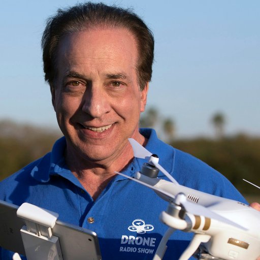
Drone Radio Show @DroneRadioShow
5K Followers 1K Following I'm Randy Goers and I produce and host a free weekly podcast about drones and the people who use them for business, fun and research.
RouteShoot @RouteShoot
924 Followers 570 Following Enabling users to record their favourite routes with #video and #GPS. Combining #maps, video and #GIS all in one #app! Get the app: http://t.co/uDPJM0v8fF
Lian Pin Koh @lianpinkoh
1K Followers 547 Following Director of the Centre for Nature-based Climate Solutions at the National University of Singapore, interested in environmental science and policy.
ConservationDrones @ConservDrones
805 Followers 220 Following
Andy Woodruff @awoodruff
7K Followers 505 Following Cartographer of things. Mostly not here anymore. https://t.co/rtJoGEi06o and/or [email protected]
MicaSense, now AgEagl... @MicaSense
4K Followers 1K Following We are now @AgEagleUAVS, provider of professional solutions in sensors, drones and software. Follow us there.
OpenTopography @OpenTopography
10K Followers 587 Following Open access to high-resolution, Earth science-oriented topography data, and related tools & resources. US NSF supported. #lidar


