JB @GoodMapBadMap
the blurry line between data and art. Wellington City, New Zealand Joined April 2015-
Tweets774
-
Followers329
-
Following2K
-
Likes3K
Setting up a new Koordinates site couldn’t be simpler. Configuration is user-friendly and needs zero technical skills. No IT or infrastructure required. Check out the video below for a quick tour of the site settings UI: 1/ Make the site your own with logos and corporate colours…
Building a Shared Map Viewer is ridiculously easy. Using Koordinates, you can quickly build a map from your data and share it with anyone you need in minutes. 1/ Add the layers you want 2/ Style the layers (using simple or professional tools) 3/ Pick a title and map settings…
Introducing new Shared Map Viewers: Web maps are powerful communication tools and have quickly become vital to sharing and exploring geospatial data. Although the industry’s tools have improved, technical know-how, licences, and hosting can still create barriers to wider use…
Esri is the world’s #1 GIS platform, but scaling up Esri REST services quickly becomes expensive and people-heavy. Koordinates makes it easier and more cost-effective to scale your use of Esri-compatible REST services and is included as part of all new Business Cloud and…
Does your team have trouble cost-effectively scaling your Esri REST services? Join our upcoming webinar to learn about Esri-compatible REST services in Koordinates Cloud. With Koordinates, teams can now scale their GIS without worrying about massively escalating licensing costs…
Check out the first section of Hawke’s Bay #LiDAR captured under the North Island Weather Event (NIWE) project. The DEM, DSM and PC are all available on the LINZ Data Service data.linz.govt.nz/layer/d3Sg8ngn… #OpenData (Image: Napier CBD colorised PC) Thanks to Hawke's Bay Regional Council

I'm often the person behind these feature videos, and this feature has been huge for me. Although simple, being able to change layer colours quickly means I can get that 80% value for 20% effort. Combining custom colours and shared Map Viewers will make sharing web maps a breeze.
I'm often the person behind these feature videos, and this feature has been huge for me. Although simple, being able to change layer colours quickly means I can get that 80% value for 20% effort. Combining custom colours and shared Map Viewers will make sharing web maps a breeze.
Coming soon to Koordinates: Shared Map Viewers that change how you view, share and explore data. Here is what you need to know: 1/ Maps on Koordinates can now be saved and shared publicly, with a group, or via a URL, just like datasets. Shared Maps have a static URL that can be…
Exciting update: Koordinates will soon offer Esri REST services for geospatial data. This means that data stored in Koordinates can be used via Esri REST Map and Feature services — immediately and at scale. Your colleagues, collaborators, or wider Esri user base can start…

I'm super excited to have taken this bid so far. Simon has done an incredible job with the preparation and now it's up to the OSGeo conference committee to make a difficult decision!

I'm super excited to have taken this bid so far. Simon has done an incredible job with the preparation and now it's up to the OSGeo conference committee to make a difficult decision!

To get the most value from geospatial data, you need three things: 1/ A 3D map viewer that supports the visualisation of vector, raster, grid, and point cloud data. This needs to be usable by everyone, not just GIS professionals. The data should be easily queried with a click…
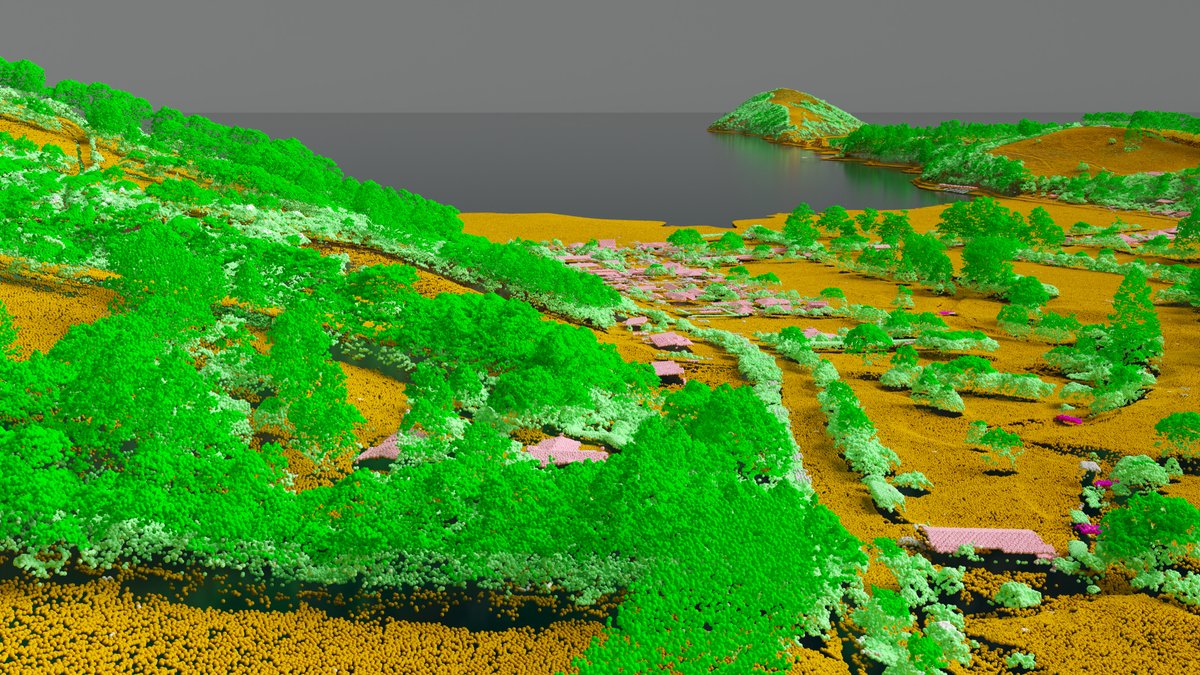
Although Point Cloud data is complex and difficult to share, we have simplified the landscape. We are very close to allowing users of all skill levels to find, view, and explore point cloud data while also helping professionals export data as DWG & LAZ.
Although Point Cloud data is complex and difficult to share, we have simplified the landscape. We are very close to allowing users of all skill levels to find, view, and explore point cloud data while also helping professionals export data as DWG & LAZ.

Open 3D map viewers for all Point cloud viz on the way
Open 3D map viewers for all Point cloud viz on the way
I did get a bit lost. Nice trip though.
I did get a bit lost. Nice trip though.
How does WSP get accurate and up-to-date geospatial data to the people who need it? We chatted with Ryan MacVeigh and Damien Cutcliffe to learn how they solve this problem with Koordinates. 3 takeaways 👇 1/ 3D digital twins are extremely useful — but pose novel data management…
We're excited to announce you can now access LiDAR Point Cloud data directly from LDS and interact with it just like any other dataset on our service. Check out our 1st point cloud datasets for Canterbury data.linz.govt.nz/layers/?kind=p… #opendata #opendataDay

Nejc Dougan, from Flai.ai gives a fantastic "Introduction to LIDAR & Point Clouds." ... well worth listening to! mapscaping.com/podcast/introd…

End users usually want data in the same way each time. Life is more complex for publishers. Try 1,000s or 100,000s of end users needing data in 100,000 combinations of APIs/Exports/Formats/Projections/AOIs. It's easier to give them everything they may need out of the box
End users usually want data in the same way each time. Life is more complex for publishers. Try 1,000s or 100,000s of end users needing data in 100,000 combinations of APIs/Exports/Formats/Projections/AOIs. It's easier to give them everything they may need out of the box
So much stale data..... Time to get better processes.
So much stale data..... Time to get better processes.

Andrew Tyrrell @SouthArrowMaps
2K Followers 214 Following 🗺🇳🇿🏔 NZ-based cartographer. Committee @NZCartoSociety. Blender, QGIS, ArcGIS Pro, Illustrator. Partial to a good mountain. @southarrowmaps.co.nz on 🦋
🥔🗺️ ᴘᴏᴋ... @pokateo_maps
28K Followers 3K Following po-KATE-o, first of her name, eater of potatoes 🥔 and maker of maps 🗺️. I make GIS (more) fun by sharing maptastic themes & original mappy memes! 🌐 ᵛᶦᵉʷˢᵐᶦⁿᵉ

LINZ Data Service @LINZLDS
2K Followers 302 Following The LINZ Data Service provides free & open access to LINZ's land & sea data. ToU: https://t.co/JlTxXbpM0r. Follow @LandInfoNZ for LINZ latest news & announcements

Thepastfromabove - Be... @Thepastfromabo1
310 Followers 478 Following Hello everyone! Come for the updates, stay for the map :) Thepastfromabove@[email protected]. 🚀
Andrew DC 🌈 @andrewdc_nz
1K Followers 222 Following Cartographer and award-winning procrastimapper. Follow @themapkiwi to keep up with my mappy projects! 🇳🇿🏳️🌈 he/him https://t.co/KmiNf1gZUL
Qiusheng Wu @giswqs
46K Followers 4K Following Associate Professor @UTKGeography | @Amazon Scholar | Talk about #opensource #geospatial #dataviz #EarthEngine
Leigh Hunt @leighghunt
901 Followers 4K Following Software Developer with a leaning towards FLOSS, Web and GIS. Drinks too much coffee, and rides a funny bike. I also help out at @CoderPorirua :-)
Koordinates @Koordinates
2K Followers 631 Following A geospatial data management platform inspired by cracking GIS data out of vendor silos. You can host, manage, share, publish, access, and build apps.
@rjhale1971@fosstodon... @rjhale
4K Followers 3K Following Owner of @northrivergeo . Enjoys adventuring, canoeing, and long walks on the beach while fixing data. #QGIS #POSTGIS #GDAL #GEOSERVER #CHATTANOOGA #HASHTAG
Christopher Beddow @cbed32
2K Followers 2K Following #openstreetmap #mapillary #gis #rapid 😎 Map Building for #AR @ Meta 🗺️ 📍Montana 🇺🇲 ➡️ Schwyz 🇨🇭 🌎 Voyager, language learner, writer, mapmaker, skier ⛷️
Marcus Blake @MarcusMapMaker
632 Followers 906 Following Geographer working to help expand the use of spatial technologies in Public Health.
Steven Ramage @Steven_Ramage
20K Followers 12K Following CEO @CEOSdotORG Committee on Earth Observation Satellites, Founder Réseau Consulting https://t.co/a9injevFpy Board @climatepolradar @GEOBON_org
Leslie @brousseau_lesli
279 Followers 3K Following
Kristina @fulmerkristina2
183 Followers 3K Following


Sheyso @SheysoEdSFvFq
72 Followers 7K Following

Pleanasmaw @PleanasmawPn33
16 Followers 1K Following
Thearez @Thearez6I2ImX
22 Followers 2K Following
Kelly Jones @KellyJo98583983
100 Followers 3K Following
Tesaneth @tesaneth99019
66 Followers 7K Following A strong woman is one who is determined to do what others are determined not to do.
Teshanea @Teshanea143971
81 Followers 7K Following A strong woman is one who is determined to do what others are determined not to do.
Randy @01f54bTfosKLv
84 Followers 7K Following
きくかわひめこ @kikukawahi77091
67 Followers 3K Following
LetitiaDorothy @9ftTpOU9La0hD
11 Followers 1K Following
EdenLancelot @H33K731WFwwZN
38 Followers 3K Following
Animals of Street Vie... @StrViewAnimals
171 Followers 605 Following Animals caught on Google Street View cameras
Notesme @Notesme45727
64 Followers 7K Following
Amelia @mitsunokei57505
88 Followers 7K Following
Helen @zn7B22u4HRiSor4
32 Followers 2K Following
Max @Max032hdnd
0 Followers 26 Following
RafaelFoos @FoosRafael10159
62 Followers 2K Following
Megan Cope @mostrarmas66
88 Followers 111 Following Old account was lost. GIS Analyst. Check out my GIS Discord. https://t.co/E0pv5fvaal
Carolyn @joyner_carolyn6
289 Followers 3K Following
Caroline @nuzbackcaroline
1K Followers 3K Following
Pamela @pamela_hatter57
289 Followers 3K Following
Citizen Science Facti... @CSciencefaction
56 Followers 385 Following Free & Frank Fellowship for Future Focused Frontiers & Fiscal Forecasts Facing Fledglings First,Fan Forum fnord Check Me Out On https://t.co/Vjfsd6hXX2
Carolyn @carolyn_daniel_
270 Followers 3K Following
Moorish @Retous260948
364 Followers 5K Following See the world on the road, and get to know yourself on the way!
urbandrone @Urbandrone_
6K Followers 3K Following _Digital Architect_ 🕊️🐛 https://t.co/pcvsUnZEpC #Alterhen ___
Deborah @deborah_wass50
269 Followers 3K Following
Scalar Alchemy @Dizmal_One
366 Followers 1K Following Creator, Preservationist, Innovator & Leader. 'Sentiēns(Ωij=∑kαk⟨ψi∣Uk∣ψj⟩ Sindicatus' Information & data posted here is&was public & sourced legitmately🐰🕳
NORTH51 Conference @N51Conference
236 Followers 306 Following We have big ideas about the future of geospatial and know you do too. Attending is more than just that, it’s about sharing and challenging the status quo.
Emily @emily_pace_
312 Followers 3K Following
Harald Tryti Rieber @0xHARALD
12 Followers 67 Following I build stuff, make maps and play music. CTO @ https://t.co/K6v5U5I3fI 🌍
Annie @l_annie82
280 Followers 3K Following
Pauline @pauline23martin
304 Followers 3K Following


Tarin Resources @TarinResources
190 Followers 834 Following Geospatial Hub - Reliable Data. Trustworthy Connections. Making geospatial data discoverable, accessible & usable.
Nick Burns @nickdaleburns
561 Followers 1K Following Data scientist, avid squash player, coffee drinker and ML Engineer. Working on self-supervised methods for vision and healthcare.

Lauren @white_lauren84
190 Followers 3K Following
Kauê @kauevestena
974 Followers 1K Following Cartographer ("GIS Specialist"), @ufpr and @polimi doctorate student, OpenStreetMap user, Open Source Enthusiast, developer
[email protected] @mshoup280010
0 Followers 3 Following
SpatialThink Lab @spa... @spatialthinklab
76 Followers 104 Following @GISTspace / Mairead de Roiste's Spatial Think Lab at Victoria University of Wellington We research maps, spatial thinking, usability & virtual reality
Carrie Adair @carrieis
565 Followers 2K Following GIS Geek • Cartographer • Wife• Mom • Caregiver • Genealogist • Vipassana Meditator • Hiker • working in the post wildfire landscape.
Mapstack @mapstack_io
319 Followers 245 Following Mapstack is the AI-powered mapping platform for business that helps your team create interactive maps in seconds.
Geoladies PH @geoladiesph
703 Followers 490 Following Advocates for diversity, collaborative participation, and affirmative spaces especially for women, LGBTQ+, differently-abled and youth communities in FOSS4G/OSM
Andrew Tyrrell @SouthArrowMaps
2K Followers 214 Following 🗺🇳🇿🏔 NZ-based cartographer. Committee @NZCartoSociety. Blender, QGIS, ArcGIS Pro, Illustrator. Partial to a good mountain. @southarrowmaps.co.nz on 🦋
🥔🗺️ ᴘᴏᴋ... @pokateo_maps
28K Followers 3K Following po-KATE-o, first of her name, eater of potatoes 🥔 and maker of maps 🗺️. I make GIS (more) fun by sharing maptastic themes & original mappy memes! 🌐 ᵛᶦᵉʷˢᵐᶦⁿᵉ
LINZ Data Service @LINZLDS
2K Followers 302 Following The LINZ Data Service provides free & open access to LINZ's land & sea data. ToU: https://t.co/JlTxXbpM0r. Follow @LandInfoNZ for LINZ latest news & announcements
Alasdair Rae @undertheraedar
44K Followers 4K Following Maps, stats, data, cities, density, elections, gifs, geo + QGIS training with Map Academy - founder of Automatic Knowledge

Joshua Stevens @jscarto
15K Followers 930 Following Cartographic Editor @mapsdotcom. Prev: DataViz Lead @NASAEarth, @NSF PhD Fellow in Big Data Social Sci @PSUGeography. Dad stuff everywhere else. Views my own.
John Nelson @John_M_Nelson
25K Followers 85 Following Maker of maps. Talker of making of maps. Purveyor of gumption. Mitten State. I make map videos now? https://t.co/lTYF0UBzhp (views mine, etc.)


Kurt Menke - @geomenk... @geomenke
8K Followers 2K Following Danish Resident 🇩🇰 | @SeptimaDK | FOSS4G user/advocate/educator | Author: Discover QGIS 3.x 2nd Ed. | Co-author:QGIS for Hydrological Applications 2nd Ed.
MapPorn @MapPornTweet
80K Followers 2K Following Official Twitter account of /r/MapPorn. Reminder: There are high-resolution images of the maps if you follow the Reddit links.
Thepastfromabove - Be... @Thepastfromabo1
310 Followers 478 Following Hello everyone! Come for the updates, stay for the map :) Thepastfromabove@[email protected]. 🚀
GeoHipster @geohipster
8K Followers 916 Following Mapping the world, one organic vertex at a time. Get your 2023 calendar now at https://t.co/BtCL7MLCnP
Andrew DC 🌈 @andrewdc_nz
1K Followers 222 Following Cartographer and award-winning procrastimapper. Follow @themapkiwi to keep up with my mappy projects! 🇳🇿🏳️🌈 he/him https://t.co/KmiNf1gZUL
Kenneth Field @kennethfield
24K Followers 95 Following Cartography is my passion & profession. Author of CARTOGRAPHY. & THEMATIC MAPPING. Maps+drums+beer+snowboards+footy+politics+sarcasm. 🇬🇧 in 🇺🇸. Views mine.
Python Maps @PythonMaps
77K Followers 569 Following Mapping the world with Python. Contact [email protected] Buy my book here - https://t.co/hAaaAxtaYB
Joe Morrison @mouthofmorrison
29K Followers 2K Following “Controversial industry figure” and General Manager of Remote Sensing at @umbraspace. We operate a private constellation of radar spy satellites.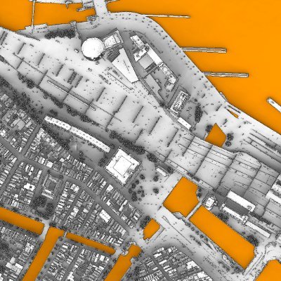
Shaded Maps @ShadedMaps
32 Followers 126 Following Digitally manufacturing detailed shaded city maps with Python, PDAL and GDAL tools from LiDAR and DSM data.


Soren Iverson @soren_iverson
292K Followers 128 Following New ideas daily. Building @iverson and @stompersapp
Zhe Zhu 🌎🛰️ @GERSLab
4K Followers 2K Following Associate Professor @UConnNRE, Director of Global Environmental Remote Sensing Laboratory, Associate & Special Issue Editors of RSE & SRS.
Mark Rein @MarkRein
143K Followers 621 Following Vice President and Co-Founder of Epic Games. Carolina Hurricanes fan.
Bonsai (previously Bl... @BonsaiBIM
5K Followers 41 Following An add-on for beautiful, detailed, and data-rich OpenBIM with Blender.
flatgeobuf @flatgeobuf
793 Followers 53 Following A performant binary encoding for geographic data based on flatbuffers
Postholer - GIS Resou... @postholer
732 Followers 166 Following GIS, Interactive & Printed Trail Maps, Data Books, Trip Planners, Snow, Wildfires, Gear Lists, Open Source. Portfolio: https://t.co/tARZ3syM4P
Antonio González Vie... @agviegasBIM
4K Followers 15 Following I was an architect until a very serious disease made me lose my job. I've seen others get it too: the disease of programming. @thatopencompany.

That Open Company @thatopencompany
3K Followers 22 Following We create the AECOsystem. The open ecosystem on which anyone can develop their own AECO software, help free the industry, and make money out of it.
Wisconsin Geological ... @WGNHS
3K Followers 466 Following We provide objective scientific information about the geology, mineral resources & water resources of Wisconsin. Tweets and links ≠ endorsement.
WY Geological Survey @WyGeoSurvey
3K Followers 121 Following Interpreting the past, providing for the future. Follow along for snapshots of Wyoming's extraordinary geology. Email: [email protected]

Rodrigo Hamuy @mrhamuy
139 Followers 380 Following

Grant Pearse @silvispacexyz
99 Followers 275 Following Interested in remote sensing, deep learning and geospatial topics.
KY Geological Survey @KGSNews
2K Followers 231 Following News and updates about the Kentucky Geological Survey (KGS). Posts also appear on the KGS Facebook page. Visit our website at http://t.co/KHzHTf497w.AZ Geological Survey @AZGeology
13K Followers 512 Following Arizona's Earth Science Agency now at the University of Arizona.
History_of_Geology @Geology_History
39K Followers 19 Following Archive dedicated to the #History of #Earth #Sciences 🌍 ⛰️🔨Utah Geological @utahgeological
9K Followers 227 Following The Utah Geological Survey (UGS) provides timely scientific information about Utah’s geologic environment, resources, and hazards.
Dylan Babbs @dbabbs
6K Followers 3K Following Co-founder at @tryprofound (hiring), control your AI presence. Prev: design eng + maps at @uber, @southpkcommons, @uw_ischool alum. Private Pilot.
Megan Cope @mostrarmas66
88 Followers 111 Following Old account was lost. GIS Analyst. Check out my GIS Discord. https://t.co/E0pv5fvaal
Structural Geology @StrucGeology
10K Followers 689 Following Christoph von Hagke and Janos Urai, Structural Geology, Tectonics & Geomechanics
Geology Tweets @GeologyTime
446K Followers 18 Following Unlocking science of minerals, crystals, fossils, gems & geology.
Information is Beauti... @infobeautiful
119K Followers 456 Following Data-visualizations & infographics made by David McCandless @mccandelish - app @vizsweet - new project @beautiful__news - https://t.co/oVLj2XZ7nf
British Geological Su... @BritGeoSurvey
52K Followers 1K Following Our vision is to be a leading and trusted provider of geological data and knowledge to meet the societal need for a sustainable future. 🌎 RTs ≠ endorsement.
Seds Online @Seds_Online
3K Followers 7 Following Seds Online - the worldwide hub for sedimentologists, provides an interactive, adaptable, accessible online community. Sponsored by @sedimentology (IAS).
GeoScienceWorld @GeoScienceWorld
26K Followers 2K Following Nonprofit collaborative dedicated to making geoscience research more discoverable and usable online, with 50 full-text scholarly journals and over 2,300 eBooks.
The Geological Societ... @GeolSoc
61K Followers 1K Following You can keep up to date with our activity on LinkedIn, Facebook, Instagram & YouTube or sign up to our newsletter at https://t.co/QcGzlhakAl
Blender Studio 🔶 @BlenderStudio_
112K Followers 3 Following The Creators Who Share. Blender Studio is part of the @Blender project.
The Chart & Map Shop @chartandmapshop
74 Followers 26 Following The world's most awesome peddler of nautical charts, maps and books plus loads of other stuff vaguely related to travel, boating and the outdoors.
Chris Penk @ChrisPenknz
9K Followers 5K Following MP Kaipara ki Mahurangi electorate. Authorised by Chris Penk, 134 Main Road, Huapai. OIAs to [email protected]
geosociety @geosociety
75K Followers 948 Following The Geological Society of America (GSA) unites earth scientists and facilitates the sharing of scientific findings about our planet and universe.
Pete Ellis @PeteEllis_x
12K Followers 244 Following Lover of Art, Fashion, Games, Techno Music, Dad Jokes, and some other stuff. Still human, still using my own brain...
SourceToSink @SourceToSink
2K Followers 481 Following Flux & fate of world large river & delta systems-from Source To Sink; sea level, delta & coastal changes; sediment transport; clinoform formation & stratigraphy
Nature Geoscience @NatureGeosci
122K Followers 305 Following A monthly journal aimed at collating top-quality research across the Earth and planetary sciences. bsky:https://t.co/jpJH7aejPs Site notice: https://t.co/33f68FcEDQ
Ye Olde Pinball Shopp... @pinballshoppe
262 Followers 339 Following The Southern Hemisphere's best pinball arcade, right in the heart of Wellington, New Zealand
Cloud Optimized GeoTI... @cogeotiff
2K Followers 11 Following I like to say that I'm like a regular GeoTIFF but in reality, I'm way better! Not a big fan of @JPEG_2000 #TeamCOG - gdal_translate -of COG
Geospatial Council of... @geo_council
855 Followers 131 Following Australia's peak body for the geospatial community was formed from the merger of SSSI and SIBA in March 2023. New members welcome.
Lauren @white_lauren84
190 Followers 3K Following
Kauê @kauevestena
974 Followers 1K Following Cartographer ("GIS Specialist"), @ufpr and @polimi doctorate student, OpenStreetMap user, Open Source Enthusiast, developer
Brandon liu bsky.app/... @bdon
2K Followers 498 Following working on @protomaps - active on bsky/masto: https://t.co/xYEcX8Yp7C @[email protected]
Rapid Editor @mapwithrapid
2K Followers 546 Following 🌎🌍🌏 Improve #OpenStreetMap w/open data, open source, thoughtful UX & machine learning. 🦾 Join the community also on Facebook: https://t.co/KQ995xWPH9
MapTiler @MapTiler
5K Followers 747 Following 🗺️ Maps for developers: Visual tools, global data, SDK & APIs for web, mobile, and enterprise applications.
Michael Bewley @michaelbewley
274 Followers 346 Following Director of AI at Nearmap. Australian data scientist, engineer, underwater roboticist. Mapping the evolution of cities with petabyte scale deep learning.
ChronoCards @get_ChronoCards
51 Followers 24 Following Manage GIS better! Activity logs, workflow documentation, & reporting tools for ArcGIS Pro. 🗺, 📊, 🗂, and 🎉 at https://t.co/KvIkH9p45kTrends for United States
You might like