InterpretGIS @InterpretGIS
Nos especializamos en análisis SIG, modelización espacial, análisis espacial, minería de datos, cartografía y tecnologías de servicios web. Bogotá, D.C., Colombia Joined February 2017-
Tweets61
-
Followers127
-
Following249
-
Likes55


¿Quién dijo que con #softwarelibre no se puede alcanzar los mismos resultados que con el software propietario? Hecho con #QGIS para #CordobaEsp Modelo digital del territorio del IGN procesado después de muchísimas pruebas a la espalda. Ahora empieza a convencerme.


10 stunning views of earth from space

Libro de la semana: Guías para la elaboración de Estudios Ambientales de Proyectos con incidencia en el #MedioNatural ow.ly/c4Xr30ohr93

“La visión de Esri para la “inteligencia de localización” es ayudar a las organizaciones a comprender por qué suceden las cosas, dónde y cuándo suceden, con el objetivo de obtener una ventaja comercial a través de una mejor comprensión."
How to Generate Vector Elevation Class Map from DEM in ArcGIS ift.tt/2L0Mc5t #gis

Ponerle IVA a la canasta básica familiar implica en el primer año una caída del salario real de todos los y las colombianas. Las centrales obreras deben ya poner fecha a la movilización nacional contra el IVA

Crear hermosos diseños de infografía comunicativa en Business Analyst es mucho más fácil de lo que piensas. Aquí están las 10 principales características clave para mejorar tu infografía. ow.ly/VKzN30mg73L

Combinaciones RGB de imágenes satélite Landsat y Sentinel gisandbeers.com/combinacion-de…
Recopilatorio de los mejores visores de teledetección para descargar imágenes satélite 🛰️ ow.ly/BVV230m5oXx #SemanaMundialDelEspacio #Teledeteccion #WorldSpaceWeek #WSW18


Map projections influence how we think about geography. Here's a simple tool to highlight their differences: p.ctx.ly/r/8g7j #GISDay #GIS #mapping #geography #geographyteacher

#CCU2018, estamos presentes, muy interesante s las conferencias.
Manual de conceptos cartográficos para elaborar un mapa gisandbeers.com/conceptos-cart…

En la siguiente entrada explicamos cómo realizar el #etiquetado de #curvas de nivel con #ArcGIS. bit.ly/EtiquetaCurvas…


De acuerdo a la aprobación de la nueva Norma De Metadatos ISO19115, el #IPGH abordó la tarea de generar la versión 2 del Perfil Latinoamericano de Metadatos (LAMPv2), relevante en los procedimientos de la información geoespacial. 🌎 Consulta: ipgh.org/assets/lampv2_…

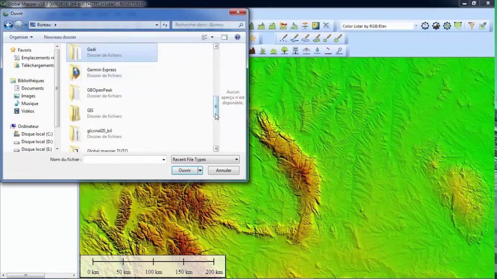
Download free DEM Digital Elevation Model 10 meters by Global Mapper ift.tt/2suXFBF #gis

Marta Sánchez @QT13RCkH4Bkys
25 Followers 2K Following 現在、アルバイトの募集をしています。勤務時間:30~90分。日給7,000円~50,000円! ✨ すぐお金になる副業 今直ぐ即金で稼ぐ事が出来る在宅ワークになります🌈 副業相談LINE追加:【https://t.co/qSK5MMQCon】
Nick @NickatWerk
1 Followers 15 Following

Sérgio Prazeres @sergi0prazeres
287 Followers 2K Following Business development manager | Project Manager | Geospatial consultant | Thesis supervisor Founder @theUSEconcept 🌻🌍🗺️🛩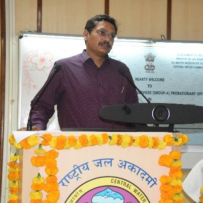
Chaitanya K S @chaitanyaks_cwc
77 Followers 735 Following Central Water Engineering Service; Currently posted as Deputy Director at National Water Academy, Central Water Commission; B Tech in Civil Engg from IIT Delhi

Dato Urbano @Urbandato
277 Followers 761 Following Ilustramos datos de ciudad a través de planos. Ilustramos información fácil de digerir. Ilustramos ciudad tal y como es. [email protected]
SpatialRelationships @SpatialRelate
59 Followers 79 Following Bringing people and information together for powerful outcomes.
FormaGIS @GisForma
370 Followers 1K Following Especializados en Sistemas de Información Geográfica (SIG), Teledetección y Bases de Datos Espaciales
Topografia2 @Topografia_2
1K Followers 840 Following Somos una página web dedicada a darte a conocer el mundo de la Topografía y ofrecerte noticias e interesantes recursos.
visgato GmbH @visgato_gmbh
204 Followers 2K Following Experte für Visualisierungen und Softwarekreationen - Entwicklung der IndoorPlan Plattform für #Mapping, #Navigation und #Tracking im Krankenhaus https://t.co/LDUpQV4hHz
RTLOC @RTLOCpos
295 Followers 1K Following High-precision scalable location tracking solutions, using ultra-wideband (UWB) technology. Track objects, athletes, vehicles and more 🚀 #RTLS
Civilju @civilju
92 Followers 806 Following Esp Geomática, Sistemas de Información Geográfica, SIG, GIS, Ing Civil, Global Mapper
Pozyx laboratories @pozyxLabs
2K Followers 3K Following Pozyx is a provider of indoor positioning solutions with centimeter accuracy using UWB technology.

Oltehua Isael @OltehuaI
10 Followers 308 Following
srivathsa vathsa @srvs8989
0 Followers 64 Following
Instituto Geográfico... @igacColombia
72K Followers 2K Following Producimos la información geográfica, cartográfica, agrológica, catastral y de tecnologías geoespaciales de Colombia. Gustavo Marulanda, Director General.


Mr Phillippe Salvato @SalvatoMr
39 Followers 496 Following
Camara @camara66851392
30 Followers 532 Following
Tito Kapet @KapetTito12
6 Followers 172 Following
CAPTA GEOi @captageoi
24 Followers 152 Following Somos una empresa mexicana enfocada en soluciones geoespaciales. En CAPTA GEOi, estamos comprometidos con la calidad de nuestros productos y servicios. 🌎🌍🌏
Strategic Genuis @Strategic_GA
128 Followers 410 Following We'll help you grow your business to the next level. We'll set up a high-converting campaign to help.
Silvia Pesci @Sil44647597
74 Followers 623 Following Amante del Arte y los Gis. trabando por un mundo mejor. Cuidemos nuestro Mundo y protejamos nuestra Educación
Ahmed Zezo @ahmedzezo20101
8 Followers 79 Following
Eng/Mohammad @EngMoha86671741
3 Followers 62 Following
Rakel_kpi @Rakel_kpi
833 Followers 2K Following Dra. Ingeniera en #Geodesia y #Cartografia. #GNSS, #Geociencias,#Geotecnologías, #BigData/#Geodesy, #Cartography, #Geosciences, #Geotechnologies
hypnoDebates @hypnognomic
43 Followers 715 Following Debates 🍥 Hypnosis by means of gnomes. #hypnognomic 🍥

Simon Kuestenmacher @simongerman600
258K Followers 216K Following German #geographer and #demographer in #Melbourne. I curate #maps and #data that explain how the #world works. Obviously all opinions are my own...
Esri SensoresRemotos @EsriColSensores
1K Followers 1K Following Las imágenes geoespaciales y los sensores remotos permiten extraer información valiosa de su entorno ¡Descúbralo! #ConMapasSeDiceMejor #MapasQueMuevenElPais

beyondwhere @beyond_where
31 Followers 348 Following Secure, open and easy to use cloud GIS platform accessible on any device from anywhere.
GeoExperiences @GeoExperiences
547 Followers 1K Following GEOEXPERIENCES. La Geomática contada de una manera diferente. Un blog mediante el cual pretendemos difundir lo que más nos gusta, que es el mundo GEO.
Cartoview @CartoView
992 Followers 1K Following #opensource #webmaps #Apps on #appmarket for Enterprise #GIS, with #python @geonode #geoportal, #mobileworkforce #dashboards #collectors #stylers #geoprocessing
Víctor Alexander @VctorAl37969872
0 Followers 54 Following
Richard @raslopes
106 Followers 1K Following
GIS Cloud @GISCloud
18K Followers 3K Following Operating on the fastest map engine available, we offer cloud-based GIS solutions for data collection, sharing, collaboration and publishing: [email protected]
GAITEC Topografía @GAITEC_Topo
663 Followers 472 Following Proyectos topográficos de todo tipo nacionales e internacionales.
Jazmín Mathews @Jazmathews
13 Followers 215 Following Ingeniera Forestal. Me gusta la naturaleza y sobre todo la unión familiar.
Gepol_GIS_Poland @GisGepol
995 Followers 4K Following Gepol Ltd was established in July 1990 as a GIS solutions provider and a software distributor.
Geophysics 2017 @Geophysics2017
212 Followers 1K Following Conferenceseries LLC all the participants across the globe to attend the "2nd International Convention on Geophysics and Geotechnics" during November 8-9, 2017
Trámites Colombia @TramitesCOL
2K Followers 2K Following Portal de información y ayuda sobre trámites en Colombia: DIAN, Fondo Nacional del Ahorro, SIMIT, Secreataría de Hacienda, ColPensiones, SISBEN, ICETEX, RUNT...
ARE @AITExtension @ARE_AITE
137 Followers 185 Following Official Twitter account of the Agriculture, Food and Environment (ARE) Program of AIT Extension
RPS-Info @info4uvs
421 Followers 778 Following Making international UVS-related information (Unmanned Aircraft Systems - UAS & UGV & UNV) available to the global UVS community https://t.co/7R4lMrlfYy
GeoInformatics @Geoinformatics1
12K Followers 4K Following GeoInformatics, knowledge for surveying, mapping and GIS Professionals. https://t.co/9lnwWufBK4
LUIS ASUNCIÓN @IngLuisPgue
7 Followers 88 Following Ingeniero Agrícola (UNIVERSIDAD NACIONAL DE PIURA),autodisciplinado, lider, social,divertido,emprendedor en busca de nuevos amigos y amigas.
Journal of the United... @Journal_UN_ONU
91K Followers 13K Following 📰 Daily programme of meetings, agenda, summaries and documents at the United Nations Headquarters 🗞️ You can also follow us on Facebook: https://t.co/gAXO6Aotoc
WorldPopProject @WorldPopProject
6K Followers 474 Following Open demographic data for decision making @unisouthampton Download our new data: https://t.co/Vh0Kj4MoIp Applications: http://t.co/ATnyKpgFWm
UNDRR @UNDRR
114K Followers 1K Following #UN Office for Disaster Risk Reduction, dedicated to building disaster #resilience and tackling #climatechange through implementation of the Sendai Framework
UN Media Liaison (MAL... @UNMediaLiaison
53K Followers 609 Following The United Nations Media Accreditation & Liaison Unit's (MALU) official account. For information and documents related to coverage of events at UNHQ
UNOSAT @UNOSAT
13K Followers 871 Following Official account of the United Nations Satellite Centre - UNOSAT, UNITAR, imagery analysis, #satellite solutions, #GIS
UN-SPIDER @UN_SPIDER
10K Followers 1K Following United Nations Platform for Space-based Information for Disaster Management and Emergency Response http://t.co/f6tIBN4y (Programme of @UNOOSA)
SGAC @SGAC
17K Followers 1K Following ▫️A Global #NGO ▫️Representing young #space professionals & students ▫️to industries, academia and space agencies #SGAC #SpaceGen
UNOOSA @UNOOSA
34K Followers 849 Following United Nations Office for Outer Space Affairs 🌌 Secretariat to COPUOS 🇺🇳 Leading entity of UN-SPACE 🛰️⚖️🌊 Capacity Builder for Member States
USGS EROS @USGS_EROS
7K Followers 156 Following USGS Earth Resources Observation and Science Center. The changing face of your planet: documented, studied & shared since 1973. Questions: [email protected]
Dato Urbano @Urbandato
277 Followers 761 Following Ilustramos datos de ciudad a través de planos. Ilustramos información fácil de digerir. Ilustramos ciudad tal y como es. [email protected]
Group on Earth Observ... @GEOSEC2025
19K Followers 4K Following 🛰️ Translating Earth Intelligence with global collaboration. ℹ️ https://t.co/I3zKOfaBls #EarthIntelligenceForAll #MapEcosystems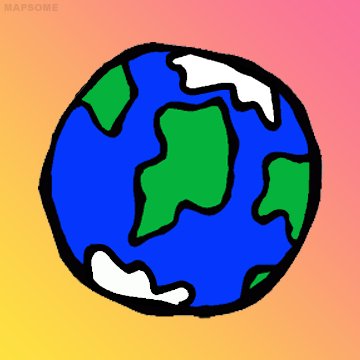
Mapsome 🌎 @mapsome
10K Followers 10 Following Just trying to explain the world. With humor sometimes.
Brilliant Maps @BrilliantMaps
128K Followers 285 Following An Atlas for Curious Minds. Order the book here: https://t.co/t7QLqVHTr3 & Join our free newsletter: https://t.co/WZmucogM64
NatGeoMaps @NatGeoMaps
37K Followers 215 Following Since 1915, National Geographic Maps has been responsible for illustrating the world around us through the art and science of mapmaking.
Women+ in Geospatial @geospatialwomen
9K Followers 298 Following This account is not active. A global community that inspires, unites and empowers women+ in the geospatial field to become strong leaders and changemakers!
Rubén Blades @rubenblades
1.0M Followers 309 Following RUBEN BLADES Página oficial • Official page | Contrataciones • Booking • Daniel Aisemberg https://t.co/7HSMAg1LpU |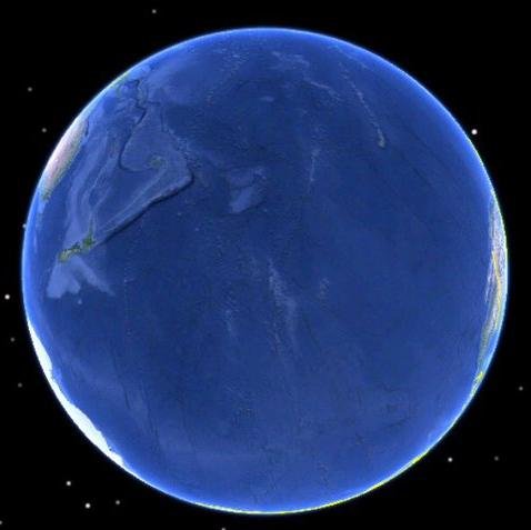
Terrible Maps @TerribleMaps
1.7M Followers 1K Following The home of terrible maps with a pinch of humour [email protected]
Amazing Maps @amazingmap
593K Followers 14K Following Amazing maps brought to your attention. Turn our tweet notifications ON to never miss a tweet! Business/Map Ideas
OnlMaps @onlmaps
92K Followers 3K Following News on maps, online maps, route planners from around the world. Tweeting about geography, space, science, news, and occasionally affiliates.
MapScaping @MapScaping
37K Followers 115 Following The MapScaping Podcast is a #podcast for the #geospatial community. Just search for "MapScaping" Wherever you get your podcasts!
MapPorn @MapPornTweet
80K Followers 2K Following Official Twitter account of /r/MapPorn. Reminder: There are high-resolution images of the maps if you follow the Reddit links.
SpatialRelationships @SpatialRelate
59 Followers 79 Following Bringing people and information together for powerful outcomes.
Maxar Technologies @Maxar
134K Followers 840 Following Maxar is a leading provider of secure, precise geospatial insights. Our products and services empower users to achieve mission success on Earth and in space.
Policía de Colombia @PoliciaColombia
1.7M Followers 122 Following Cuenta oficial de la Policía Nacional de Colombia. #DiosYPatria
Missing Maps @TheMissingMaps
18K Followers 3K Following A humanitarian project that maps areas to meet the needs of vulnerable communities. An open collaboration building on #OpenStreetMap Join us!
FME Evangelist @FMEEvangelist
2K Followers 340 Following The FME Evangelist (aka Mark I) delivers insider news, cutting edge examples and the latest functional developments in FME. An official account of @SafeSoftware
FME Data Integration @SafeSoftware
5K Followers 2K Following Gain more value from data by connecting it across hundreds of sources with FME – the # 1 platform for integrating spatial data. #FME #DataIntegrationPlatform
Matchmore @Matchmore_SA
195 Followers 570 Following A new cloud service for creating highly dynamic location-based applications.
GISinc, a Continental... @gisincorporated
2K Followers 446 Following A GIS professional services firm delivering customer-driven location technology solutions to federal, state & local governments, and commercial organizations.
SEWIO @SEWIOnet
1K Followers 1K Following Sewio is a #UWB based real-time location system (#RTLS) for indoor positioning that drives business results for companies of all sizes.
Grizzly Analytics @GrizzlyAnalytic
194 Followers 111 Following
Geo IoT World @GeoIoTWorld
355 Followers 181 Following Where Geolocation Powers IoT Innovation | June 11-13, 2018
IOT Solutions World C... @IOTSWC
24K Followers 678 Following Connect to the Next Level 📡 #IoT Solutions World Congress | #IOTSWC25 | 📍 @fira_barcelona
NACIS @NACIS
8K Followers 430 Following Do you #lovemaps? The North American Cartographic Information Society has been the home for map enthusiasts since 1980. Learn more at https://t.co/Hv52ISpktf!
Geógrafos de Madrid @GeografosMadrid
2K Followers 144 Following Perfil oficial del Colegio de Geógrafos en Madrid. Contacta con nosotros a través de Twitter o a través de [email protected]
GeoHipster @geohipster
8K Followers 916 Following Mapping the world, one organic vertex at a time. Get your 2023 calendar now at https://t.co/BtCL7MLCnP
GeoTux (https://fosst... @GeoTux2
2K Followers 89 Following (EN/ES) Soluciones Geoinformáticas Libres. 18 years promoting and sharing FOSS4G. We've moved to https://t.co/0hBRe3nKrF See you there!
Aprendices SENA Colom... @AprendicesSENA_
11K Followers 7K Following Perfil de aprendices del #SENA | Para información oficial siga a @SENAComunica y envíe sus preguntas a https://t.co/FdgnCKQ2SF…
miso @miso_beanne
7K Followers 2K Following
geomatico.es @geomati_co
2K Followers 316 Following Geospatial web development and GIS analysis. From environmental to mobility map viewers and dashboards.
Cartolab @cartolab
2K Followers 178 Following Laboratorio de Ingeniería Cartográfica de la Universidade da Coruña / Descubre @_emapic
OSGeo-ES @osgeoes
2K Followers 80 Following
Simon Kuestenmacher @simongerman600
258K Followers 216K Following German #geographer and #demographer in #Melbourne. I curate #maps and #data that explain how the #world works. Obviously all opinions are my own...
ExpertGIS @ExpertGIS
1K Followers 421 Following Expertos en sistemas de información geográfica #GIS #SIG #ArcGIS #Mapas
Cartoview @CartoView
992 Followers 1K Following #opensource #webmaps #Apps on #appmarket for Enterprise #GIS, with #python @geonode #geoportal, #mobileworkforce #dashboards #collectors #stylers #geoprocessing
Planet Scope @planetscope
16 Followers 2 Following
Katie Decker @GlobalDecker
5K Followers 4K Following Esri Startup Program Senior Partner Mgr. Wisdom is knowing what to do next; skill is knowing how to do it & virtue is doing it. Opinions are my own.
GAITEC Topografía @GAITEC_Topo
663 Followers 472 Following Proyectos topográficos de todo tipo nacionales e internacionales.
NRGS @NorthRiverGeo
591 Followers 448 Following Located in Chattanooga TN and working with #FOSS4G. Geo Tools in the Toolbox: #QGIS, #PostGIS, #Geoserver, #GDALTrends for United States
You might like

