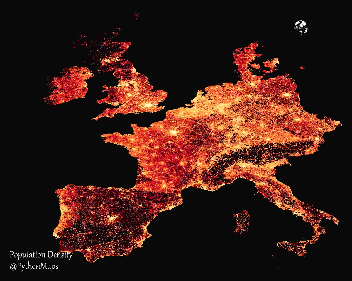
Population density of Europe! I used GHSL data with Rasterio/Matplotlib to produce this. Why don't you have a go and post your maps in the comments! #Europe #PopulationDensity #Map #Demographics #Urbanization #CityLife #Countryside #CensusData #Insightful #Geography

@PythonMaps Lovely 😍 Here's my map based on the 2018 GEOSTAT population grid data created in R with #rayshader library #RStats #DataScience #dataviz #maps #geospatial
@PythonMaps Missing countries aside, what happened with Corsica & Mallorca?

@PythonMaps Here's one of Germany that I've made recently.


@PythonMaps Strange definition of Europe you've got there!

@PythonMaps I did one for latam


@PythonMaps I am very impressed with this GIF of Hambach, biggest open-pit coal mine in Germany.

@PythonMaps This is like showing a map of the western US and calling it "A MAP OF THE USA" You have ommited like over half of the countries on the European continent and called it "a map of Europe"... Dude...

@PythonMaps "eUrOpE" ending on Kattegat, Oder-Neisse and Triest. Scandinavia, CEE and SEE are not in Europe, but somewhere else.


@PythonMaps Where is the center of gravity of the European/EU population according to your data?

@PythonMaps If this is Europe, where did the Nordics go?