Search results for #MondayMappery

For this week's #MondayMappery we look at John Robertson’s ‘Plan of the City of Dublin’ published in Edinburgh in 1782. Featuring placenames such as Bloody Bridge and Dirty Lane, it shows Collins Barracks being right on the edge of Dublin, with countryside beyond. Check out…

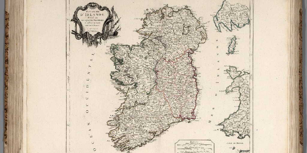
This week's #MondayMappery features Giles Robert de Vaugondy ‘Royaume D'Irlande divise en ses quatre Provinces, et subdivisé en Comtés, Par le St. Robert’ published in 1780 in Paris. Courtesy of Barry Lawrence Ruderman Antique Maps View in hi-res here: ow.ly/60UO50Rllmr

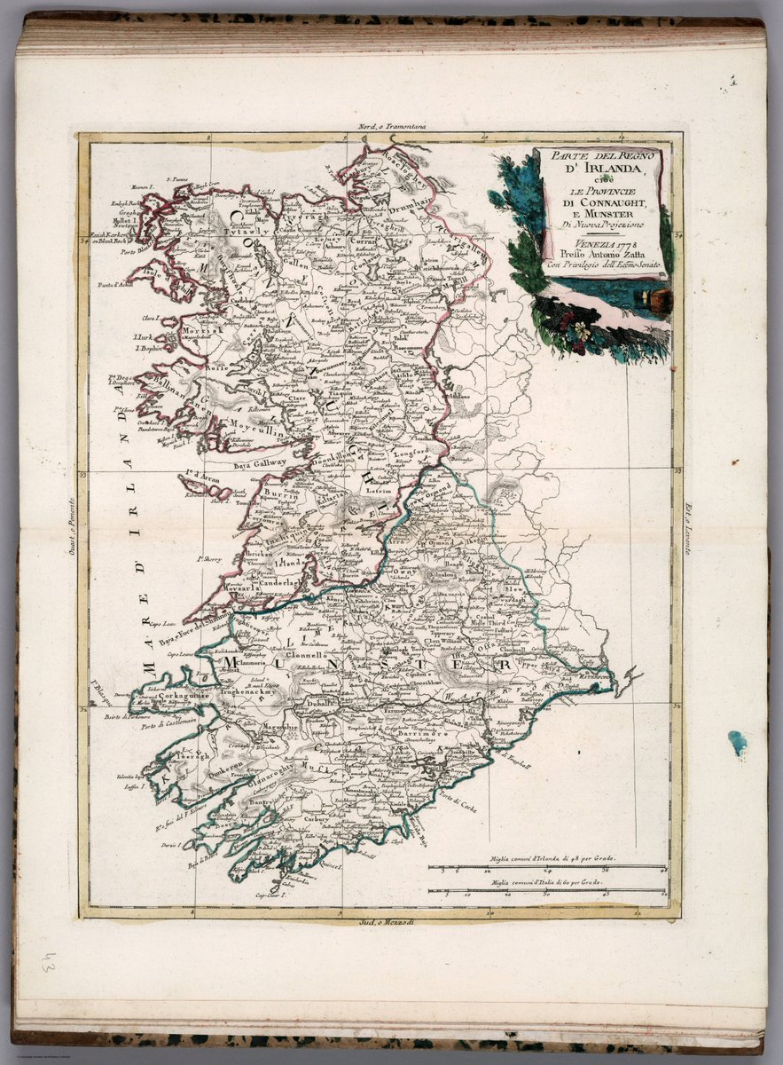
This week's #MondayMappery features a two-part map of Ireland by Zatta and Zuliani, published in 1778 in Venice as being ‘Di Nuova Projezione’ (of new projection). The information featured within the map comes from older previously featured maps, but the country is presented as…


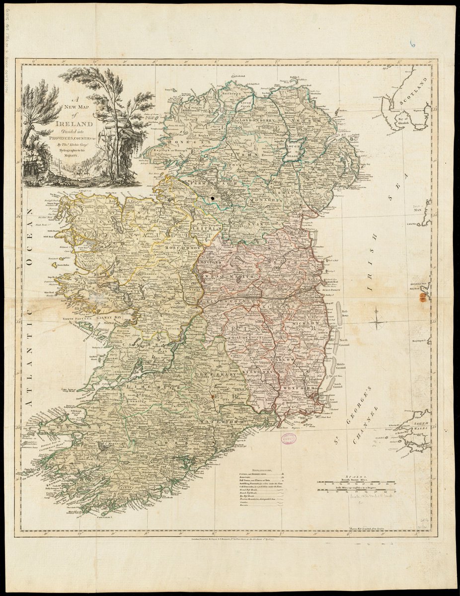
This week's #MondayMappery features ‘A New Map of Ireland’ by Thomas Kitchin ‘Hydrographer to his Majesty’ published in 1777 in London. Interesting Cartouche set into top left corner, cleverly hugging the Mayo and Donegal coastlines. This map appears courtesy of the Leventhal…
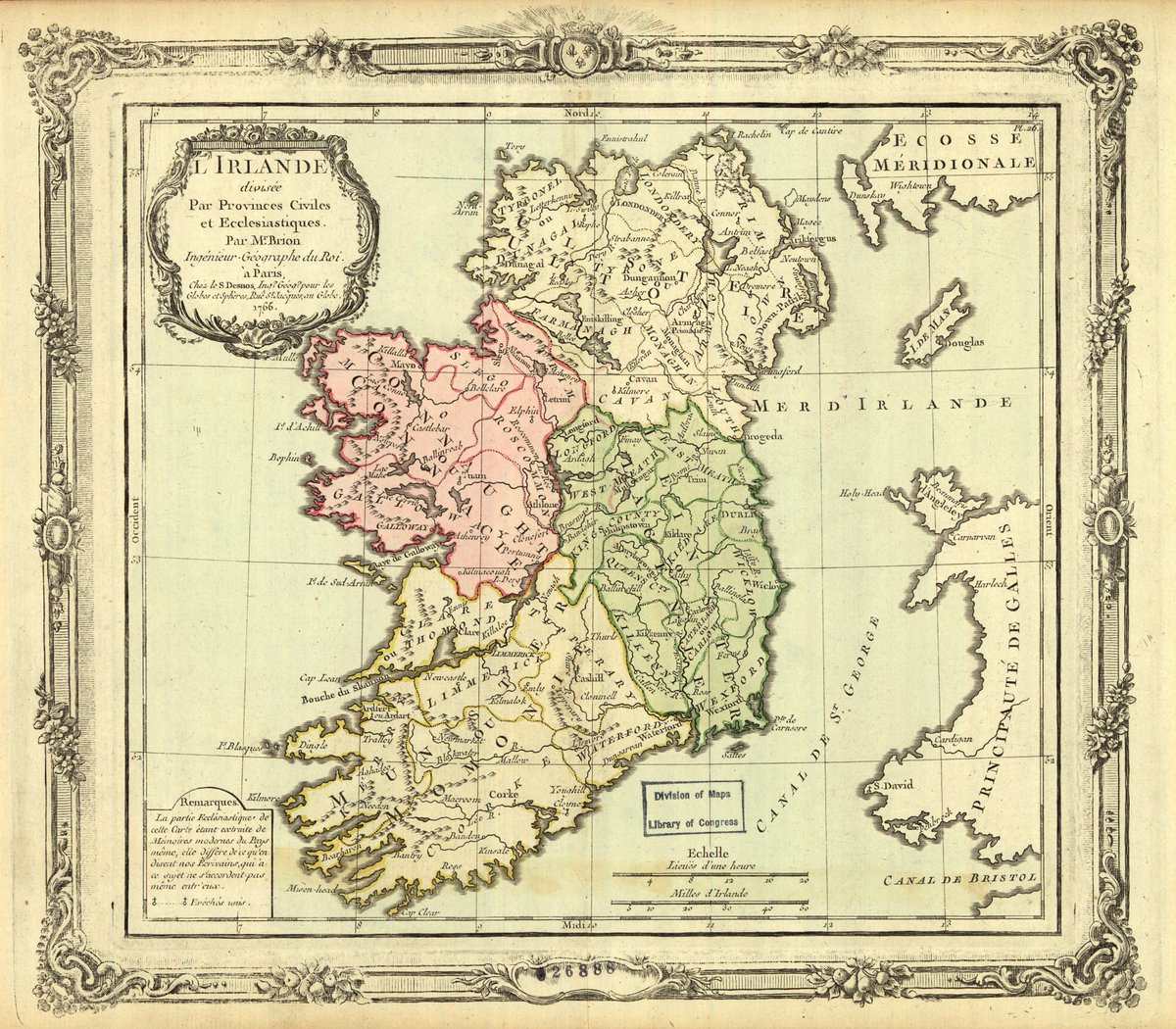
In today's #MondayMappery we look at a beautifully hand coloured map of Ireland by Louis Brion de la Tour from 1766 when he was just 23. It maps the provinces of Ireland and the main ecclesiastical centres of each county. Courtesy of the US Library of Congress. View in hi-res…
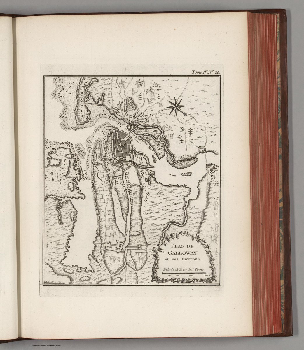
For this week's #MondayMappery, we look at Bellini’s maps of Dublin and Galway, published in 1764. The Dublin map shows important buildings and the Galway map outlines the fortifications of the city. Both maps are beautifully drawn with decorative cartouches. These maps appear…

This week's #MondayMappery features Paolo Santini’s map ‘Royaume d'Irlande’ published in Venice in 1778. Santini used the Robert de Vaugondy brothers' 1757 map as his base, adding current knowledge to it for inclusion in his Atlas. This map appears courtesy of @DavidRumseyMaps
For this week's #MondayMappery look at Antonio Zatta’s unusually represented maps of Ireland from his World Atlas Published in 1788, though drawn in 1778. Maps appear courtesy of the Rumsey Map Collection.

For this week's #MondayMappery, we look at two city plans for Dublin and Galway by Bellini, published in Paris in 1764 from his coastal mapping work ‘Petit Atlas Maritime’. These maps appear courtesy of the @DavidRumseyMaps at Stanford University View in hi-res here:…


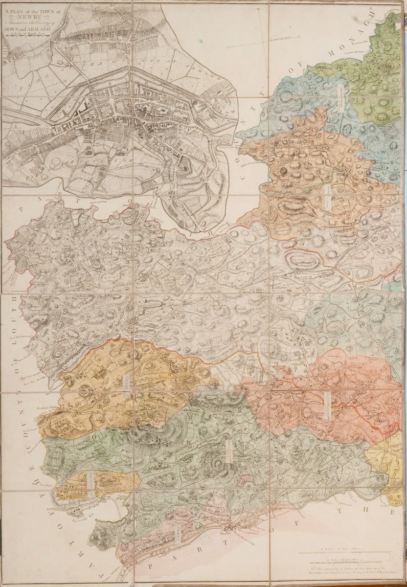
For this week's #MondayMappery we look at Rocque’s two-page ‘Topographical Map of the County of Armagh to which is anex'd the Plans of Newry and Armagh’ published in London in 1760. Courtesy of logainm.ie View or download the images at ow.ly/fwtF50Qt3vx and…

This week's #MondayMappery is Thomas Jeffrey’s 1759 ‘Map of the Kingdom of Ireland’ featuring the ‘Great, the Branch & the By-Post Roads’ and the subsisting and cast (abandoned) barracks. Courtesy of the David Rumsey Map Collection View in hi-res here: ow.ly/Rn9w50QqTIr

This weeks #MondayMappery features a Gibson and Bowen map published in 1758 in London. From the ‘Atlas Minimus… with Historical Extracts relative to each’ of the Empires, Kingdoms and States featured. Some interesting facts about Ireland feature on this map, demonstrating the…

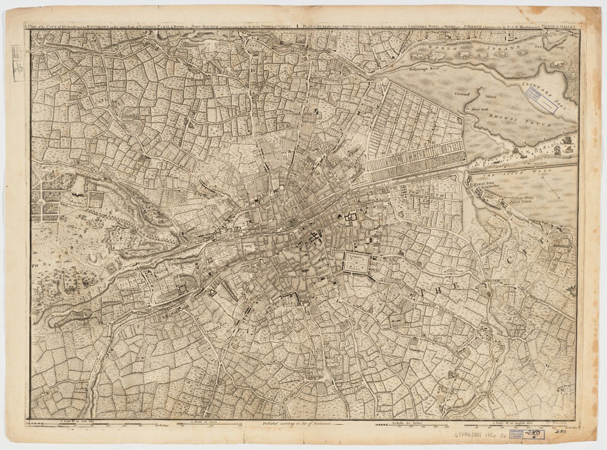
For our first #MondayMappery of the year, we look at Rocque’s maps of Dublin City from 1756. These maps capture the city in great detail, and the fabric of the old city can still be seen today. Courtesy of the Harvard University Map Collection. Hi-res at ow.ly/swNi50Ql26H

Published in 1735, Matthaeus Seutter's map ‘Regnum Hiberniae is beautifully drawn and detailed. It features wonderfully drawn cartouches. #MondayMappery This map appears courtesy of the David Rumsey Map Collection. View in hi-res at ow.ly/RFeE50QjG6m

This week's #MondayMappery looks at Leonhard von Euler’s map ‘Mappa geographica Regni Hiberniae’ published in Berolini (Berlin) in 1753. A wonderfully detailed hand-coloured copperplate engraving on two sheets. This map appears courtesy of the David Rumsey Map Collection…

For this weeks #MondayMappery, we feature a map by Gilles Robert de Vaugondy, published in 1750 in Paris. Wonderfully detailed, featuring some interesting spellings of small village names across the country. This map appears courtesy of the Rumsey Map Collection. View in…

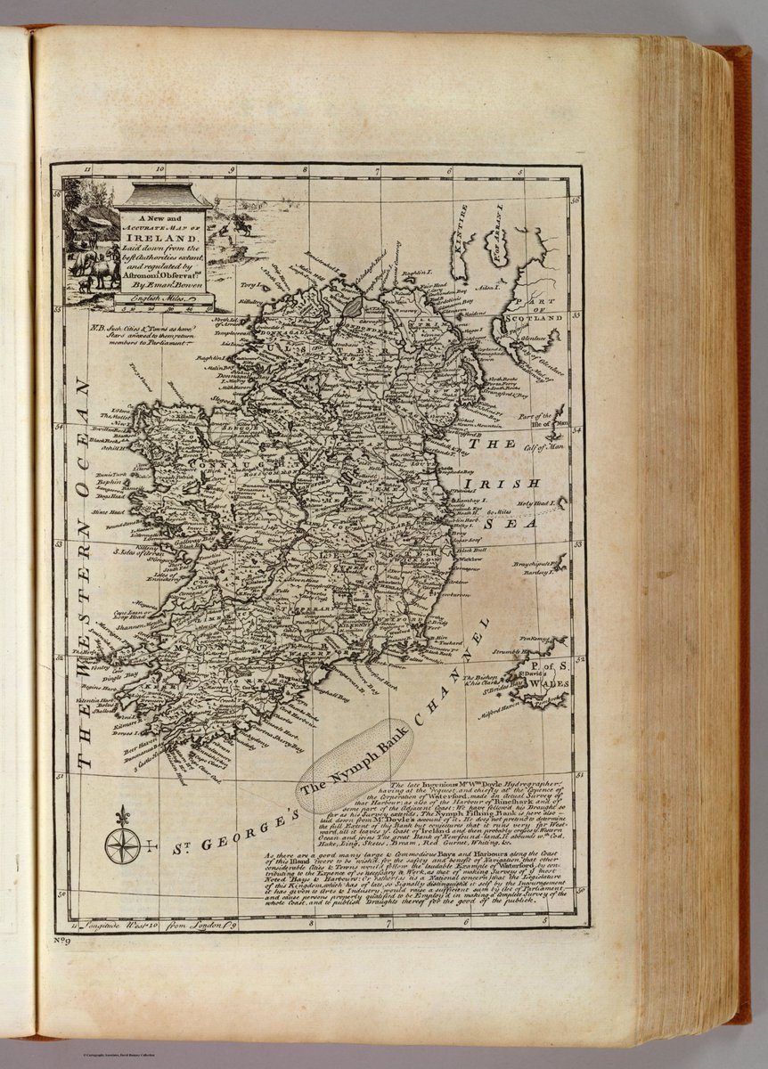
For this week's #MondayMappery, we look at two maps by Emanuel Bowen published in London in 1747. One features ‘Great Britain and Ireland’ and the other is a ‘Map of Ireland’. The map of Ireland features cities and towns that return members to parliament, and it singles the Port…

For this week's #MondayMappery, we follow up on Mattheus Seutter’s work with this stunning map of Ireland published in 1740. It contains the various tiers of church sites across the four provinces. This map appears courtesy of BLR Antique Maps View in hi-res at…

This week's #MondayMappery features three very different maps - by Johann Schrieber, Mattheus Seutter and the Homann Heirs - having varying levels of information, but all beautifully hand-coloured, featuring wonderful cartouches and map elements. Published in 1740. These maps…


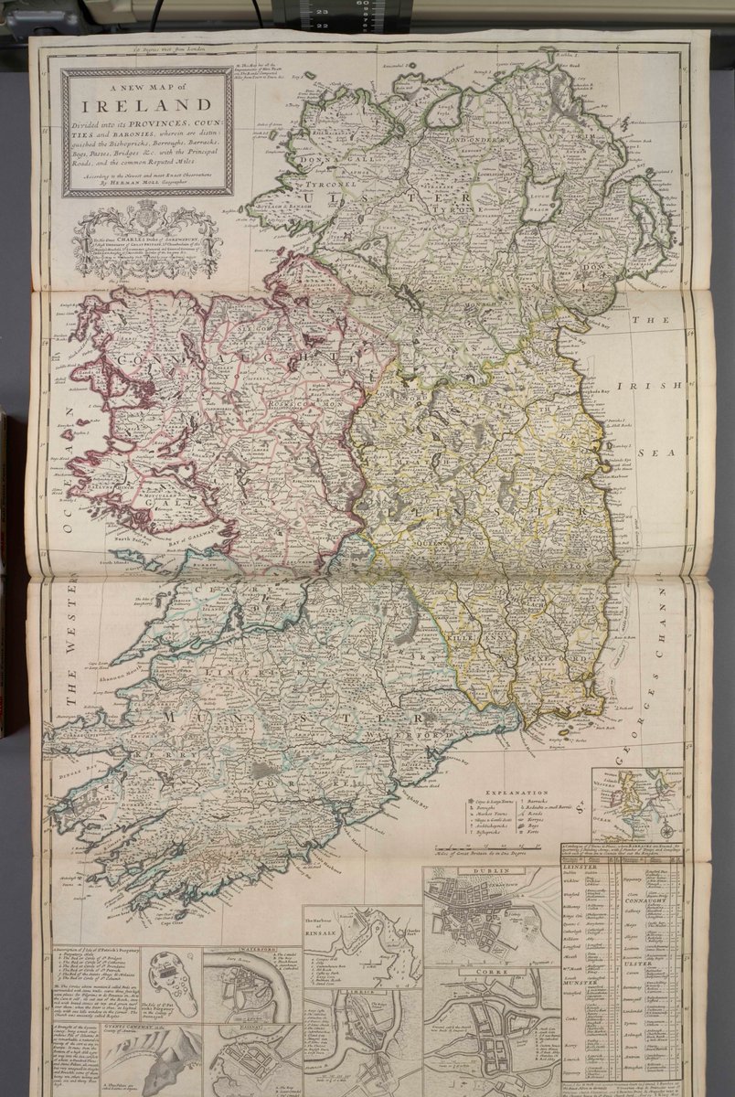
This week's #MondayMappery features two maps from 1736, both by Herman Moll and both published in London. They are very different maps, one being from a ‘pocket companion’ and the other from ‘A new and correct sett of maps’. Both contain details of barracks and military presence…