GeoDataPoint @GeoDataPoint
Follow for all the latest breaking news, products, articles, and events in the geospatial industry. Everything from LiDAR to drones are covered in detail. geodatapoint.com Troy, MI Joined January 2012-
Tweets4K
-
Followers2K
-
Following349
-
Likes208
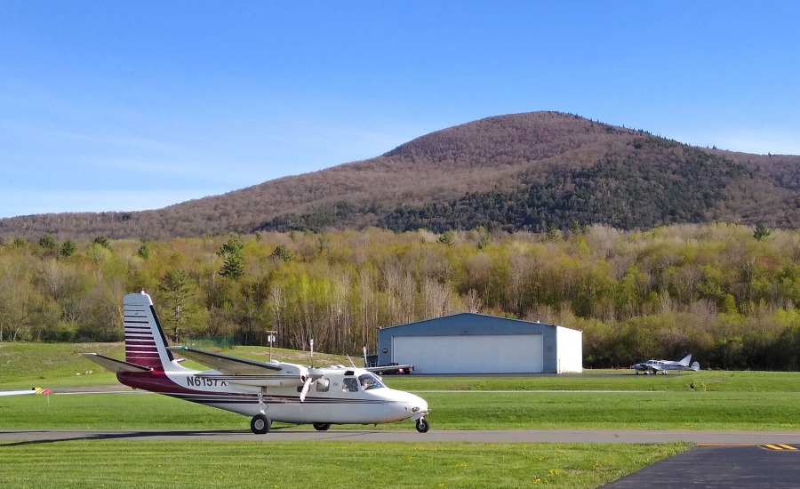
Aerial mapping company Bluesky recently completed a topographic survey of the old Anchor Color and Gum Works site in Dighton, Mass., ahead of remediation efforts. fal.cn/geodatapoint
Read about Fei Jiang, Ph.D., GIS and machine learning expert at PlantVillage and her ten year journey with GIS technologies: pobonline.com/articles/10238…

With professional paths shifting beneath their feet, many more women like Ruth L. Trujillo Rodriguez, PLS, are finding stability in leading land surveying and geospatial work: pobonline.com/articles/10238…

A farmer in Belgium accidently moved his country’s border with France after moving a stone marker out of the way of his tractor. pobonline.com/articles/10237…
Land surveyors can submit photos from the field and see them published in Point of Beginning magazine: pobonline.com/POB-point-and-…
TerrainMapper-2 from @LeicaGeosystems integrates LiDAR and imaging for regional mapping projects: pobonline.com/articles/10226…
New Android-based construction layout solution from @CarlsonSoftware: pobonline.com/articles/10227…
A fixed-wing drone (from @sensefly) survey captures spectacular images: pobonline.com/articles/10225…
Photogrammetry vs. LiDAR: Applying the Best Technology for the Job: pobonline.com/articles/10226… #CEU #LandSurveying
.@sensefly drone technology helps conservation project earn award: pobonline.com/articles/10226…
European Space Imaging, the leading supplier of global imagery in Europe and North Africa, joins as a founding member of the Global Consortium. pobonline.com/articles/10226…
GNSS visionary Dr. Javad Ashjaee has died due to coronavirus complications: pobonline.com/articles/10216…
The upcoming Geo Week has been canceled: pobonline.com/articles/10210…
Happy #GIS Day! GIS Day provides an international forum for users of GIS technology to demonstrate real-world applications that are making a difference in our society. bit.ly/2PD8H5i
Are you celebrating #GIS Day this Wednesday? What are you doing? How are you celebrating? Let us know! bit.ly/2PD8H5i
BOO! Happy Halloween from GeoDataPoint!

Geospatial technologies, such as #GIS, aerial and satellite imagery, are being recognized as valuable tools in the aftermath of Hurricane Irma. bit.ly/2ynXsE6 #geospatial
Satellite imagery and remote sensing products are helping rebuilding efforts during and after natural and man-made disasters. #geospatial bit.ly/2ypPx8Z
The greatness of #geospatial information rests in its universal application to almost any subject. The flip side is managing what can quickly become an overwhelming amount of content. bit.ly/2C3iYR3

🥔🗺️ ᴘᴏᴋ... @pokateo_maps
28K Followers 3K Following po-KATE-o, first of her name, eater of potatoes 🥔 and maker of maps 🗺️. I make GIS (more) fun by sharing maptastic themes & original mappy memes! 🌐 ᵛᶦᵉʷˢᵐᶦⁿᵉ
LAND SURVEYORS UNITED... @LandSurveyorsU
10K Followers 578 Following ʟᴀɴᴅsᴜʀᴠᴇʏᴏʀsᴜɴɪᴛᴇᴅ.ᴄᴏᴍ #ʟᴀɴᴅsᴜʀᴠᴇʏᴏʀs ᴛᴀᴘ ɪɴᴛᴏ ᴛʜᴇ #sᴜʀᴠᴇʏɪɴɢ ᴇxᴘᴇʀɪᴇɴᴄᴇ ᴏғ ᴏᴠᴇʀ 21ᴋ #sᴜʀᴠᴇʏᴏʀs ɪɴsɪᴅᴇ ʟᴀɴᴅ sᴜʀᴠᴇʏᴏʀs ᴜɴɪᴛᴇᴅ ᴄᴏᴍᴍᴜɴɪᴛʏ. ᴊᴏʙs, sᴜᴘᴘᴏʀᴛ & ᴍᴏʀᴇ ✊
Lidar News @lidarnews
6K Followers 1K Following Managing Editor of LiDAR News. Built Environment industry veteran focused on promoting, improving and developing the 3D laser scanning and lidar industries.


Adam Carnow @SpatialAce
3K Followers 3K Following Public Works Industry Specialist @Esri. Opinions are mine. Bottom line: I help people make better decisions with the power of location. https://t.co/vHWEFg5b5v
Geospatial Profession... @URISA
10K Followers 3K Following The Geospatial Professional Network (formerly URISA) is a community of emerging and experienced GIS professionals.
Geosun Navigation @GeosunNav
1K Followers 4K Following Make the LiDAR/SLAM solution more affordable and applicable.
Hexagon @HexagonAB
13K Followers 751 Following When it has to be right. Hexagon - the global leader in measurement technologies. From micron to Mars, we measure what matters for the future.
NYSAPLS @nysapls
732 Followers 251 Following NY State Association of Professional Land Surveyors, providing critical information, education, networking opportunities and business resources.
GeoMax UK @GeoMax_UK
1K Followers 4K Following The fastest growing brand of surveying instruments in UK and Ireland. Outstanding GNSS, Total Stations, Lasers and Software for Surveyors and Civil Engineers.
Esri India @EsriIndia
3K Followers 3K Following Esri India offers end-to-end GIS based solutions including software products, application development, training, data conversion and technical support.
ClearEdge3D @ClearEdge_3D
832 Followers 898 Following Makers of Verity™ and EdgeWise™—construction verification and 3D modeling software. @Verity_3D @EdgeWise_3D
Sean @AirshotLive
89 Followers 177 Following
mildness @mildness474416
49 Followers 4K Following

SkyHaul ADA @Skyhaul_ADA
1 Followers 11 Following Located in Cincinnati, Ohio SKYHAUL A.D.A. is your trusted partner for cutting edge aerial data solutions. LiDAR, Photogrammetry, Thermal Inspections
Shanraha16 @shanraha16
107 Followers 239 Following Sean - God, Family, Country: All at the same time
Alvaro Botana da Rosa @x2xalfax
0 Followers 64 Following
Carlos Jimenez @chjimenezr
279 Followers 3K Following IT technologies, Hydrology, CFD, Dynamic Modeling, Sustainable Development, Trading and Entrepreneurship.
M4RCUS @check_mate_001
37 Followers 1K Following
Mark Levitski @MarkLevitski
5K Followers 1K Following Freelance lidar and photogrammetry processor and educator. Tesla investor.

The prince @jaydon_mogusu
49 Followers 392 Following

RETINAproject @retinaeu
32 Followers 53 Following
Mahesh Yalamanchili @y_mahesh15
39 Followers 532 Following Entrepreneurship, Stock markets & Healthcare
3D Scanning Los Angel... @3DScanLA
548 Followers 3K Following 3D Head and Body Scanning Los Angeles excels in delivering 3D assets for VFX, Games, AI, VR, Game, Music Video, 3D Printing, TV, XR, VR, Photogrammetry etc.
Gumnaam @Gumnaam4848551
1 Followers 42 Following
narendraphalle @pnarend02861379
0 Followers 25 Following

Kamasia Sylvester @KamasiaSyl59024
7 Followers 173 Following

Paul W Heselwood @PaulWHeselwood
290 Followers 1K Following Course Director & Lecturer of Evidence-Based Policing (EBP), Investigation, OSINT/3i - interested in research, evaluation and learning.
Kiklo.eu @EuKiklo
553 Followers 3K Following @EUKIKLO is #spinoff company of #AUTH - Aristotle University of Thessaloniki, providing scientific #expertise and service to #innovative #technologies #products
Macbeth @Macbeth69309687
80 Followers 511 Following Like Wrexham AFC, History & Rugby. Lived & worked in London, Hong Kong, Seoul, Tokyo, Kilkenny & Cardiff. Played football for Hong Kong Univ & Seoul FC

raaghul ranganathan @raaghul_92
0 Followers 124 Following
Topografía en USA @TopografiaenUSA
2 Followers 20 Following With 12 years' experience in topographic surveys, I work with LiDAR, 3D Laser Scanners, GNSS, Total Stations, Level, Civil 3D. Enseño Topografía, Habló Español.
illilove @IlliCrystal
123 Followers 1K Following
V B Rock @Scorpio30051
33 Followers 1K Following

Софи♉️ @ajifos_
59 Followers 102 Following
26th Parallel North @26thParallel
48 Followers 181 Following 26th Parallel North is a Professional Drone Service company that serves the Agriculture, Construction, Surveying and Real Estate Industries.

SandscapeGeospatial @SandscapeGeo
22 Followers 301 Following Realtime geospatial insight - everything happens somewhere at sometime
Suggestions for You @Suggestions4YOU
1K Followers 2K Following Making the world a better place, one suggestion at a time! I don't cook but I love people who do #suggestions4you #architectLINK
Purusottamk @Purusottamk1
33 Followers 578 Following
lidar @lidar64832506
0 Followers 11 Following
vGIS @vGIS_Map
2K Followers 1K Following Leading #AugmentedReality #AR-powered Construction Coordination platform. #BIM, #GIS, #3DScans and #RealityCapture. @Autodesk, @Esri and @Microsoft partner.
Alex Archijoy @archijoyAlex
77 Followers 1K Following I'm running an as-built Revit 3D modeling and AutoCAD drafting service for surveyors, architects and contractors who work with laser scanners and/or BIM.
Hitoshi Nakahara @Riku1247
161 Followers 333 Following 地球に生まれて四半世紀とちょい。あと半世紀は成長期。 #LiDAR #DRONE で測量やってるおじさん🫠 二級建築士 DJICAMPインストラクター ※個人アカ

Kristofer Kelley @MyNameISLiDAR
22 Followers 313 Following Industrial #drone #LiDAR, #Photogrammetry and #software manufacturer, I have your answer to 3D #mapping… so follow me!

Nimbalpudi Rao @ssshkrao8227
0 Followers 148 Following I am Shyamkiran Rao from Andhra Pradesh and Odisha. Currently staying in Bangalore. I had completed my Master's in Computer Science in Sambalpur University...


BEAD @BirdsEyeDrones
587 Followers 1K Following An SDVOSB company providing turnkey aerial imaging. Improve your ROI. Aerial data, mapping, environmental, entertainment, AEC, Marketing. FAA approved, insured.
Dennis @dennisl2907
272 Followers 3K Following
Phoenix LiDAR @PhoenixLiDAR
2K Followers 967 Following We build modular LiDAR systems for aircraft, drones, and mobile applications, and offer cloud post-processing for LiDAR data.
Charlotte Dab @dab_charlotte
0 Followers 29 Following
Radiator @Radiator1981
21 Followers 3K Following
LAND SURVEYORS UNITED... @LandSurveyorsU
10K Followers 578 Following ʟᴀɴᴅsᴜʀᴠᴇʏᴏʀsᴜɴɪᴛᴇᴅ.ᴄᴏᴍ #ʟᴀɴᴅsᴜʀᴠᴇʏᴏʀs ᴛᴀᴘ ɪɴᴛᴏ ᴛʜᴇ #sᴜʀᴠᴇʏɪɴɢ ᴇxᴘᴇʀɪᴇɴᴄᴇ ᴏғ ᴏᴠᴇʀ 21ᴋ #sᴜʀᴠᴇʏᴏʀs ɪɴsɪᴅᴇ ʟᴀɴᴅ sᴜʀᴠᴇʏᴏʀs ᴜɴɪᴛᴇᴅ ᴄᴏᴍᴍᴜɴɪᴛʏ. ᴊᴏʙs, sᴜᴘᴘᴏʀᴛ & ᴍᴏʀᴇ ✊
Lidar News @lidarnews
6K Followers 1K Following Managing Editor of LiDAR News. Built Environment industry veteran focused on promoting, improving and developing the 3D laser scanning and lidar industries.

Hexagon Safety, Infra... @HexagonSIG
10K Followers 609 Following Improving resilience and sustainability for the world’s critical services and infrastructure | Part of @HexagonAB
Unmanned Systems Tech... @UnmannedSystem
31K Followers 5K Following UST provides the latest #news and #technological developments in #unmanned/#uncrewed including #drones #AUV #UGV #robotics.
Adam Carnow @SpatialAce
3K Followers 3K Following Public Works Industry Specialist @Esri. Opinions are mine. Bottom line: I help people make better decisions with the power of location. https://t.co/vHWEFg5b5v
Geospatial Profession... @URISA
10K Followers 3K Following The Geospatial Professional Network (formerly URISA) is a community of emerging and experienced GIS professionals.
USGS @USGS
779K Followers 93 Following Science is only a tweet away. Tweets do not = endorsement: https://t.co/VoRuucTNuK
Greg Fiske @g_fiske
4K Followers 2K Following Putting science on the map @WoodwellClimate | Cartographer | Analyst | Senior Research Associate | Insta: greg.fiske | Bsky: @gfiske.bsky.social
Hexagon @HexagonAB
13K Followers 751 Following When it has to be right. Hexagon - the global leader in measurement technologies. From micron to Mars, we measure what matters for the future.
Jarlath O'Neil-Dunne @jarlathond
3K Followers 1K Following Director @ University of Vermont Spatial Analysis Lab, veteran, geospatial nerd, drones, year-round bike commuter
Jeff Harrison @JeffHarrison
3K Followers 2K Following Working on interoperability, geosocial networking and democratic access. Recovering entrepreneur, intelligence officer, open geospatial guy.
Maxar Technologies @Maxar
134K Followers 840 Following Maxar is a leading provider of secure, precise geospatial insights. Our products and services empower users to achieve mission success on Earth and in space.
MappingGIS 🚀🌍 @MappingGIS
24K Followers 296 Following Formación que impulsa tu perfil GIS. Cursos online de #QGIS #R #IA #PostGIS #webmapping #python #GeoServer #OpenLayers #Leaflet #MapStore #teledeteccion
sUAS Consultancy @SuasConsultancy
976 Followers 774 Following DRONE CONSULTANCY SPECIALIST - Tina Brevitt - Founder SUAS-Global #UAV #UAS #Drone #Drones #sUAS #Consultant #RPAS #Unmanned #Defence #Security
Intterra @intterra
591 Followers 1K Following Intterra has been on a mission to arm fire agencies with big-data solutions to ensure they'll be better informed, more flexible, safer, and community driven.
Joe Blair @joeblairvc
3K Followers 4K Following Venture Investor @BayBridge_VC, Host @EpicHumanPod Investing in companies solving the most critical problems facing the environment & humanity
Michael Anderson @MikeOnMachines
4K Followers 5K Following Customer Experience Representative, Robert's Equipment, Chesley, Ontario, Canada. Proud Resident, County of Grey, Ontario, Canada.
ENR CBS @ENR_CBS
266 Followers 19 Following Strategic leadership insights and analysis from @ENRNews specifically geared to contractors. Photo: Dennis Lee
DroneDeploy @DroneDeploy
34K Followers 755 Following The only reality capture platform that combines robotic automation, AI agents and a truly unified system.
Aethon Aerial Solutio... @AethonAerial
199 Followers 124 Following Remote sensing solutions service provider for LiDAR, imagery, and sonar solutions for water and land management and infrastructure.
DroneShow @DRONEShowLA
1K Followers 543 Following DroneShow 2026, de 16 a 18 de junho no Expo Center Norte - Pavilhão Azul, em São Paulo (SP), Brasil
Avineon, Inc @AvineonUS
275 Followers 975 Following Avineon, Inc. is a specialized provider of information technology, engineering support, and geospatial services.
GSSI GPR @GSSI_GPR
1K Followers 139 Following World Leader in Ground Penetrating Radar #GPR/ #Georadar. Proudly made in the USA
IMAGINiT @IMAGINiT_Tech
4K Followers 2K Following Provider of design and engineering solutions to the building, manufacturing, and infrastructure industries. Autodesk Authorized Reseller. #IMAGINiT
Septentrio @Septentrio
2K Followers 176 Following Highly accurate & reliable GPS/GNSS receivers with industry leading interference mitigation and monitoring (AIM+).

SITECO Informatica @SITECO_Bologna
425 Followers 546 Following MOBILE MAPPING SYSTEM - FACILITY MANAGEMENT SYSTEM - PAVEMENT MANAGEMENT SYSTEM for Roads and Airports
Dewberry @TheDewberryWay
2K Followers 445 Following Dewberry is a leading, market-facing AEC firm with a proven history of providing professional services to a wide variety of public- and private-sector clients.
URISA's GISCorps @GISCorps
3K Followers 2K Following GISCorps coordinates short-term, volunteer-based GIS services to communities in need worldwide. BlueSky: https://t.co/1n9LXV9fZX
Commercial UAV News @ExpoUAV
11K Followers 2K Following Leading online platform for the commercial drone market! Presentor of: Commercial UAV Expo & Commercial UAV Forum
Hemisphere GNSS @HemisphereGNSS
2K Followers 937 Following Hemisphere GNSS, Inc. is an innovative high-tech company that designs and manufactures heading and positioning products, services, and technology.
Applied Aeronautics @applied_aero
472 Followers 1K Following Applied Aeronautics is a manufacturer of affordable long-range drones for commercial and government customers | #yourmissionisourmission
NGA @NGA_GEOINT
102K Followers 210 Following This is the official account for the National Geospatial-Intelligence Agency.
TCarta @TCarta_
797 Followers 870 Following Innovation in mapping. Bathymetry, satellite derived coastal, marine, and terrestrial products. Follow us on Facebook, Instagram and LinkedIn!
Drone World Expo @droneworldexpo
4K Followers 1 Following Follow on @ExpoUAV. Now incorporated with Commercial UAV Expo, the leading commercial drone market event. Oct 1-3, 2018 #expouav18
Trimble Inc. @TrimbleCorpNews
12K Followers 59 Following Trimble is a global technology company that connects the physical and digital worlds, transforming the ways work gets done.
Association for Uncre... @AUVSI
29K Followers 759 Following AUVSI is the world's largest nonprofit organization dedicated to uncrewed systems and robotics. | https://t.co/3tHYAEvRuv
INTERGEO @InsideIntergeo
4K Followers 530 Following 24 - 26 September 2024 | STUTTGART | The World's No.1 Event for the Geospatial Community | Digital Twins, Digital Mapping, BIM, Smart City, UAV
Rapid 5D @Rapid5D
709 Followers 2K Following Rapid5D is leading the implementation of collaborative #VDC & #BIM solutions throughout the UK construction industry. Trimble Authorised Distributor in the UK
ClipCard @ClipCard
368 Followers 358 Following ClipCard was the fastest way to get to your stuff, anywhere you were working. http://t.co/2tT3y6871B
Mladen Stojic @Mladen_Stojic
1K Followers 554 Following I like dynamic maps and apps and use them as a form to inform and inspire.
Vexcel Imaging @vexcel_imaging
778 Followers 51 Following Vexcel Imaging is a global leader in aerial imaging, known for developing cutting-edge aerial cameras, mapping systems, and photogrammetric processing software.
Robert E. Roth @RobertERoth
2K Followers 647 Following Professor @UWMadisonGeog & Faculty Director @UWCartLab. I teach & research interactive, online, & mobile mapping. He/him. #uwcart #mapsrock
Nathan @TheRascala
391 Followers 990 Following Coursera dropout searching for a garage !! Data and Analytics @Mekanism
IMGS @IMGS_Ireland
603 Followers 366 Following Data Intelligence & Information is at the core of what we do. We provide solutions to automate #data flows, visualise information & power data insights.
Alan's gone birding @alanGeoVISTA
1K Followers 153 Following GIScience Emeritus Prof at Penn State - geovisualization, visual analytics, cartography, spatial cognition, geographic info retrieval @[email protected]
Joshua Stevens @jscarto
15K Followers 930 Following Cartographic Editor @mapsdotcom. Prev: DataViz Lead @NASAEarth, @NSF PhD Fellow in Big Data Social Sci @PSUGeography. Dad stuff everywhere else. Views my own.
Yuri @[email protected]... @YuriEngelhardt
2K Followers 401 Following I have left Twitter. Find me on: Mastodon: https://t.co/ZU6e0siNrT Bluesky: https://t.co/4EmSggBGY0 LinkedIn: https://t.co/NdFlAzZ8q4
Andy Woodruff @awoodruff
7K Followers 505 Following Cartographer of things. Mostly not here anymore. https://t.co/rtJoGEi06o and/or [email protected]
Julie Koesmarno @MsSQLGirl
4K Followers 2K Following Bringing value to data & insights through experiences users 💚. GPM @Microsoft #Dataverse. Dream, create, inspire. Tweets/opinions are mine. (She/Her)
Xavi Giménez @xavigimenez
928 Followers 1K Following Interactive Data Journalist @TheEconomist / Data Visualization lecturer at @UOCuniversity
Anthony Robinson @A_C_Robinson
3K Followers 1K Following Professor @psugeography & Director of Online Geospatial Ed @PennStateGIS & GeoGraphics Lab. Past-Prez @NACIS, vice chair @icaviz.
Edward Jurkevics @EdJurkevics
187 Followers 402 Following Talk to me about: satellite communications, small-sat constellations, OneWeb, space finance.
Alexandra Grounds @AlexCGrounds
1K Followers 926 Following PM and digital construction. Sense of fun and ridiculous. Motorsport Marshal, Exhibited Landscape Photographer and triathlete.
AtkinsRéalis @atkinsrealis
49K Followers 4K Following We are a world-class engineering services and nuclear organization. Nous sommes une organisation de calibre mondial de services d’ingénierie et du nucléaire.
Rick Stavanja @stavanja
1K Followers 714 Following Montana-born Nerd, #Engineering Software Analyst , Blogger, #CAD Society President, Cancer survivor, #Packer fan, & recovering smart-ass.
Matt Blackwell @DigitalTriplet
2K Followers 563 Following Work Winning & BD at Cohesive Group. Gadget-lover extraordinaire. Likes dogs, Devon, Xbox and distilleries. On a mission to ban celery. FIET. All views my own.
BIMhub @BIMhub
874 Followers 2K Following Looking to increase profits and ROI in construction? We Excel in Providing Superior BIM Services.
Microsol Resources, G... @MicrosolTweets
543 Followers 568 Following We empower our design & construction clients to effectively adapt tools and get the most out of their innovative technology solutions.
Assemble, an Autodesk... @AssembleSystems
1K Followers 519 Following Assemble Systems | An Autodesk Company – provides a #SaaS solution that acts as a HUB consuming #BIM, drawings, and point clouds for key #AEC workflows.

Michael O'Connell @mike_oconnell
350 Followers 484 FollowingTrends for United States
You might like