
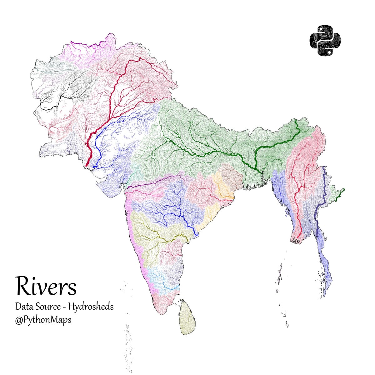
Another thread of maps I like. This time we are looking loosely at the Indian sub continent. Included are India, Pakistan, Afghanistan, Nepal, Bhutan, Bangladesh, Sri Lanka and Myanmar. First up, Rivers! 1/13
Population - using data from @KonturInc 2/13


@PythonMaps Shouldve included the Tibetan plateau too for continuity of the rivers

@PythonMaps Always love your maps thanks! Can you also make topography+river system maps, as you once did for african one?
@PythonMaps Are the maps not distorted ? Please be sensitive when posting.

@PythonMaps Use your map of your own country , Afghanistan is Persia and should be with (great) Iran.

@PythonMaps Your thread is creating a buzz! #TopUnroll threadreaderapp.com/thread/1778471… 🙏🏼@aklecz for 🥇unroll


@PythonMaps You’re missing portions of Ladakh

@PythonMaps I’d like to think that major river basins are the atomic units of a common civilization/culture. You are an empire if you govern more than one major river basin, because you are truly uniting two different cultural traditions

@PythonMaps Can you please make a map of density of investors/ traders in India , thanks in advance

@PythonMaps Dude the map of Indian boundaries are wrong. Please correct it asap


@PythonMaps The map is incomplete as you haven't included aksai Chin, Indian map is incomplete without it,