
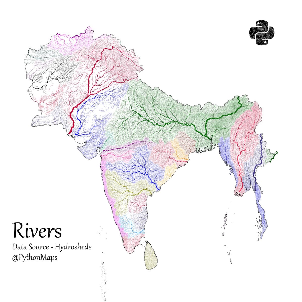
Another thread of maps I like. This time we are looking loosely at the Indian sub continent. Included are India, Pakistan, Afghanistan, Nepal, Bhutan, Bangladesh, Sri Lanka and Myanmar. First up, Rivers! 1/13
Population - using data from @KonturInc 2/13

Forests - using everyones favourite colourmap. 😉3/13


@PythonMaps @KonturInc Where is the border data from? It's incorrect for India

@PythonMaps @KonturInc You have plotted wrong Map of India not showing Kashmir as part of India. This is unacceptable

@PythonMaps @KonturInc Dark spots are forests 🌳 or open lands

@PythonMaps @KonturInc There are places with more than 50k/sq. km? Wow

@PythonMaps @KonturInc if the map you are showing here is boundaries of countries, you have to immediately remove this post. how dare you to reduce india map at north. correct this asap or remove this


@PythonMaps @KonturInc Proximity of the vale of Kashmir to Pakistani heartland is striking.