GIS Association of Alabama @gisaa_al
Professional GIS growth in AL. Educational Workshops, Networking Opportunities, & Online Resources. biolinky.co/gisaa Alabama, USA Joined January 2019-
Tweets368
-
Followers218
-
Following355
-
Likes785
As we progress into November, Alabama is beginning to see peak fall foliage! Check out the 2023 Fall Foliage Map & Nationwide Peak Leaf Forecast. Map -> smokymountains.com/fall-foliage-m… #Fall #GISAA
Curious about what to do with your leftover Jack-O-Lanterns? Check out this story map promoting low-waste solutions! Story Map -> storymaps.arcgis.com/stories/f8431a… #GIS #GISAA #storymaps
The Alabama State Data Center (ASDC) will be hosting a free virtual conference discussing Census Bureau data! Learn more about Census data and hear updates about the Economic Census. Learn more and register here -> cber.culverhouse.ua.edu/2023/10/10/fre… #Geography #GIS #Census #Alabama #Data
Don't forget to check out the Alabama Maps website hosted by the Department of Geography, University of Alabama at alabamamaps.ua.edu. The website is a wonderful repository of over 75,000 historical and modern maps, aerial photographs and interactive maps.
This week we're at our annual #GeoforGood23 summit. We're joined by people from all over the planet to learn, share, and collaborate on geospatial technology to make a positive impact on the planet. 🙌 🌎🌍🌏
It's #EarthScienceWeek and #EarthObservationDay! 🌎 To celebrate, we're sharing our favorite posters from past years that explore how #Landsat benefits society. Download your favorite: go.nasa.gov/3RRb3gw
The Little Colorado River has sustained plants, animals, and humans since the beginning of time. For #IndigenousPeoplesDay, meet the people who have called it home for millennia. Story by @GrandCanynTrust: storymaps.arcgis.com/collections/2a…
One month away! Join us and explore new, exciting tools and features available with the upcoming @ArcGISPro 3.2 release. 🔹Save your spot: esri.social/OVSS50PUbcv
How often does a satellite see another satellite? #OTD in 2022, Maxar’s WorldView-3 satellite snapped a sequence of images showing #Landsat 8 in orbit. 🛰️ Read more at: go.nasa.gov/3LRBTkW
How often does a satellite see another satellite? #OTD in 2022, Maxar’s WorldView-3 satellite snapped a sequence of images showing #Landsat 8 in orbit. 🛰️ Read more at: go.nasa.gov/3LRBTkW
We're celebrating #WorldSmileDay with free #GIS training for all! 😊😊😊 esri.social/12mX50PTIoM
Don't miss out on the 2023 GIS of Alabama Conference! Register now and book your hotel room by October 20, 2023. Find more information at gisaa.org/event-4909698 #GIS #Alabama #GISAA #GISA
2️⃣0️⃣ days until MOOC opening day! Join our (free + new) #GIS for #ClimateAction course and learn how YOU can make a difference. 💚Register: esri.social/Z6xc50PTImq
Happy #WorldHabitatDay! 🌍 Today, we celebrate five decades of #Landsat science used to understand, conserve, and protect our planet’s precious habitats. go.nasa.gov/3ryWdAu
Amazing creativity and a beautiful display of stonework at 458 Gunter Av, Guntersville, Alabama! Mr. Jeff Morrison, President of ‘American Lumber and Plywood’ sent us these wonderful photographs and a beautiful “thank-you” note today.
❄️ Save the date for January 19 & 20th, 2024...#MappingUSA is back! This free, virtual conference features a few days of talks, workshops, mapping parties, networking, and all things #OpenStreetMap. Attend from anywhere! Register 🔗 buff.ly/48zJcHE #MappyMonday
Registration and abstract calls for the 2023 AWI Symposium are now open! Registration closes March 27 at 8 a.m.: bit.ly/3R4zQLN Abstracts are due Feb. 27 at 8 a.m. with decisions sent by March 10: bit.ly/3R5jmD0 We hope to see you there! #AWI #AWISymposium
On December 10, 1817 Mississippi became the 20th state. Alabama was once part of the Mississippi Territory and it became its own territory in 1817. Alabama eventually became its own state two years later in 1819. Image of a map from 1817

Qiusheng Wu @giswqs
46K Followers 4K Following Associate Professor @UTKGeography | @Amazon Scholar | Talk about #opensource #geospatial #dataviz #EarthEngine
BWRiverkeeper @BWRiverkeeper
12K Followers 12K Following Our mission is to protect and restore the Black Warrior River and its tributaries. Member of @Waterkeeper and @WaterkeepersA.
Geospatial Profession... @URISA
10K Followers 3K Following The Geospatial Professional Network (formerly URISA) is a community of emerging and experienced GIS professionals.
🥔🗺️ ᴘᴏᴋ... @pokateo_maps
28K Followers 3K Following po-KATE-o, first of her name, eater of potatoes 🥔 and maker of maps 🗺️. I make GIS (more) fun by sharing maptastic themes & original mappy memes! 🌐 ᵛᶦᵉʷˢᵐᶦⁿᵉ
Alabama Water Institu... @AlabamaWater
978 Followers 339 Following AWI's research focuses on earth systems science, water resource management, sustainable waterways, water quality and biological diversity of aquatic systems.
Dr. Leigh G. Terry @leighterry_h2o
413 Followers 263 Following Associate Professor, Environmental Engineering, University of Alabama
TennesseeRiverkeeper @TNRiverkeeper
13K Followers 13K Following Nonprofit. TN Riverkeeper’s mission is to protect the Cumberland and Tennessee Rivers by enforcing environmental laws and educating the public. @DavidWhiteside
Nate Jones @FloodHydrology
6K Followers 4K Following Water Scientist | Assistant Professor @UofAlabama | Views are my own
McSlytue @McSlytueJgBlFL
0 Followers 209 Following
Angelwing @Angelwing13650
42 Followers 4K Following
Swynutea @SwynuteaU0AAEg
15 Followers 227 Following
MurielMatthew @87bf5W3V2CdwP2z
76 Followers 7K Following
Troy Geospatial @GeospatialTroy
52 Followers 44 Following Troy University Geospatial Informatics Department offers a degree in Surveying and Geomatics Sciences and Geographic Information Sciences (GIS).
StaceyChaucer @b8TiG8YXEDr5LzK
77 Followers 7K Following
Ynot @AlisonYgis
81 Followers 157 Following Energetic professional helping government leverage maps and location analytics for transparency and decision making.
Nel @Jan66863492
28 Followers 392 Following
Stiro @stiro2076
36 Followers 1K Following I live alone now and enjoy business, traveling, shopping, food and music. I have a calm personality and I hope we can be friends.
April Bagwell @aprilbagwell
181 Followers 704 Following Mother, cartographer, ocean lover, Bama fan, military brat, chief mapper for St. Clair County, AL
TJ @TCrum100
56 Followers 679 Following
GIS Resources @GISResources
2K Followers 640 Following GIS Resources is global platform for geospatial latest news & insights, developments, jobs, webinars, articles, data, conferences and tenders.
Graveyard Walker @kaelle74
1K Followers 4K Following #Taphophile #Cemetery #Photography #UrbEx #History #Psych #MCR #GreenDay #Killjoy #Idiot #Goth #Punk #MS #Auburn 💗 my kids (#missing one) #DHS
GIS Lab @Opelika_GIS
1 Followers 38 Following
Gezaho.com @Emmy12003
233 Followers 157 Following
Jackson Miller @J_Miller1234
54 Followers 1K Following
GeoDesk @GeoDeskTeam
147 Followers 511 Following Developers of the fastest and smallest spatial database for @OpenStreetMap data. Analyzing geographic features has never been easier! 100% FOSS 🚀
Rural Geography Speci... @RuralGeo_AAG
517 Followers 606 Following Offical: RGSG_AAG Moto: Promotion & Development of Work correlating with Rural Ethos. #RuralJEDI #JustRuralfutures Edited by: @lavanya_G_, @Grete_Rural & Aida
Shelisa Gardner @GardnerShelisa
1 Followers 155 Following
Lavanya Ashokkumar @glacier_lavanya
150 Followers 273 Following Research Scientist | Educator | glacier modeling, remote sensing, global sea-level change
Auburn University at ... @aumontgomery
4K Followers 812 Following The official account of Auburn University at Montgomery, a U.S. News & World Report-ranked regional comprehensive university in Alabama's capital city.
Department of Geograp... @BamaGeography
889 Followers 321 Following Official Twitter account of @UofAlabama, Department of Geography & the Environment
Ari Isaak☮️ @SDGIS
2K Followers 3K Following Family man & small business owner, #SanDiego #Yimby, #liberal, bicyclist, climate warrior, T1 diabetic, KenTal CPG, pistachios & whiskey/mezcal, lox
The Alabama Beacon @alabamabeacon
52 Followers 449 Following Founded 1840, re-established 2022. Covering Alabama from the Appalachian foothills to the Gulf Coast, and from the Black Belt to the Wiregrass.
Ryan Newton @rynewt
14 Followers 189 Following USAF Veteran; Studying GIS at the University of North Alabama
GITA @GITAssociation
4K Followers 368 Following #gita Official feed for the Geospatial Information & Technology Association. Today's GITA has community, purpose, history, and relevancy. All it needs is you!
Urban Pulse @UrbanPulseUS
264 Followers 2K Following Economic Development, Planning, Real Estate and Government Services Firm. Community focused!
Jose Augustine @mysticbot_
186 Followers 1K Following Gis Analyst at the Town of Huntsville (Muskoka)
Geosun Navigation @GeosunNav
1K Followers 4K Following Make the LiDAR/SLAM solution more affordable and applicable.
Urban Sky @urbanskyimaging
699 Followers 582 Following Better imagery. Better planet. Zero-emission Remote Sensing from the Stratosphere, Driving Insights to Improve our World 🌎 📸
Bryan Gurney @B_Gurn
274 Followers 1K Following The Eagle flies on Friday, Saturday I come out to play.
Push2Breathe @Push2Breathe
142 Followers 374 Following Fighting opioid crisis- Push2Breathe is a part of Harvard NPLI Cohort 15 developing a playbook to build first responder Naloxone programs. NPLI Hall of Fame ‘18
Lisa Keys-Mathews @lkeysmathews
483 Followers 1K Following UMCNA Developer. Mentor. Coach. Lay Leader. Geographer. NatGeo Explorer. Professor Emeritus. Love to hike, walk, & travel; living into my second half of life.
Marsha Holley @MarshaMarie_
278 Followers 725 Following
Dr Proloy Deb @ProloyDeb
215 Followers 301 Following Postdoctoral Fellow at the International Rice Research Institute, New Delhi Specialization in Hydrology, Data Assimilation, Crop Modeling, Climate Change
Alabama Archaeologica... @AAS_SAC
72 Followers 403 Following Alabama Archaeological Society Student Advisory Council | Coordinating and Connecting students within the Alabama archaeological community.
Pointerapp @Pointerapp1
28 Followers 220 Following Hi there, we from Pointerapp are there to make your Citizen Science project easier!
UA Anthropology Dept @BamaAnthro
630 Followers 541 Following 4-field BA major & minor & MA, and PhD tracks in Biocultural Medical Anthro & Archaeology of the Americas. Insta/Threads @bamaanthro, search UAAnthroDept on FB
GeoRobotix @GeoRobotix
170 Followers 895 Following Rapidly integrate your Sensors, Things & Robots into a seamless, interoperable 4D environment with a commercial SaaS subscription of OpenSensorHub.
Qiusheng Wu @giswqs
46K Followers 4K Following Associate Professor @UTKGeography | @Amazon Scholar | Talk about #opensource #geospatial #dataviz #EarthEngine
BWRiverkeeper @BWRiverkeeper
12K Followers 12K Following Our mission is to protect and restore the Black Warrior River and its tributaries. Member of @Waterkeeper and @WaterkeepersA.
Geospatial Profession... @URISA
10K Followers 3K Following The Geospatial Professional Network (formerly URISA) is a community of emerging and experienced GIS professionals.
Humanitarian OpenStre... @hotosm
28K Followers 2K Following Reposting key info from our Open Regional Hubs here. For updates, follow us in Bluesky at @hotosm.org
American Association ... @theAAG
28K Followers 2K Following AAG is an academic & professional organization representing educators, researchers, & practitioners in geography. Also at https://t.co/7KuoPU2oO9
ARCHIVED - NASA Lands... @NASA_Landsat
78K Followers 437 Following We’ve moved! Visit https://t.co/ObKiWKvAMz or follow @NASAEarth & @NASAGoddard for future Landsat updates.
🥔🗺️ ᴘᴏᴋ... @pokateo_maps
28K Followers 3K Following po-KATE-o, first of her name, eater of potatoes 🥔 and maker of maps 🗺️. I make GIS (more) fun by sharing maptastic themes & original mappy memes! 🌐 ᵛᶦᵉʷˢᵐᶦⁿᵉ
Alabama Water Institu... @AlabamaWater
978 Followers 339 Following AWI's research focuses on earth systems science, water resource management, sustainable waterways, water quality and biological diversity of aquatic systems.
Freshwater Land Trust @FreshwaterLT
1K Followers 730 Following We conserve land and build trails in Central Alabama! Explore #redrocktrailsystem using our trail map. Link below.
Google Earth @googleearth
1.2M Followers 289 Following Discover geospatial datasets and tools, AI capabilities, and planetary-scale insights from Google Earth, Google Earth Engine and Google Maps Platform
Dr. Leigh G. Terry @leighterry_h2o
413 Followers 263 Following Associate Professor, Environmental Engineering, University of Alabama
USGS Landsat @USGSLandsat
37K Followers 219 Following The Landsat Program is a series of Earth-observing satellites, co-managed by @USGS and @NASA. Delivering decades of Earth imagery, since 1972. 📡🛰️
Women+ in Geospatial @geospatialwomen
9K Followers 298 Following This account is not active. A global community that inspires, unites and empowers women+ in the geospatial field to become strong leaders and changemakers!
TennesseeRiverkeeper @TNRiverkeeper
13K Followers 13K Following Nonprofit. TN Riverkeeper’s mission is to protect the Cumberland and Tennessee Rivers by enforcing environmental laws and educating the public. @DavidWhiteside
Nate Jones @FloodHydrology
6K Followers 4K Following Water Scientist | Assistant Professor @UofAlabama | Views are my own
-- -- --------- @i_ameztoy
35K Followers 4K Following Inspired by many, hopefully inspiring some 🛰🌍 #EO HD videos: https://t.co/Ve1ceCEHO2 Full Size imgs: https://t.co/SjqrH2iHcD
Python Maps @PythonMaps
77K Followers 569 Following Mapping the world with Python. Contact [email protected] Buy my book here - https://t.co/hAaaAxtaYB
Katmai National Park @KatmaiNPS
163K Followers 352 Following The official Twitter Katmai National Park & Preserve in Southwest Alaska. Volcanoes, coast, tundra, cultural history, and the @exploreorg #bearcam. 🐻🐟🌋🌲
NOAA Satellites @NOAASatellites
1.5M Followers 648 Following The NOAA Satellite & Information Service (referred to as NESDIS) is a line office of @NOAA.
Eliane Volk @ElianeVolk
12 Followers 29 Following Graduate Research Assistant at the University of Alabama, Dept. of Civil, Construction & Environmental Engineering
NORAD Tracks Santa @NoradSanta
210K Followers 75 Following Official page of NORAD Tracks Santa, providing up-to-the-minute information on Santa's journey! #NoradTracksSanta https://t.co/YglGGcMNW9
Last Lecture Series @UALastLecture
65 Followers 114 Following Each year The University of Alabama student community honors a faculty member with their own Last Lecture.
Geoawesome @geoawesome_dgtl
25K Followers 6K Following Open and inclusive community platform for geospatial experts and enthusiasts. Building bridges across sectors and industries. All things GEO awesome 🌎 🛰🗺🚀
MapScaping @MapScaping
37K Followers 115 Following The MapScaping Podcast is a #podcast for the #geospatial community. Just search for "MapScaping" Wherever you get your podcasts!
Gulf Coast GIS User G... @GulfCoastGISUG
12 Followers 31 Following
UGA Center for Integr... @UGACICR
2K Followers 4K Following Center for Integrative Conservation Research (CICR) 🌿 | 🌎https://t.co/mh1bGqdCpF | CICR inspires new visions for conservation and environmental decision-making.
GeoHipster @geohipster
8K Followers 916 Following Mapping the world, one organic vertex at a time. Get your 2023 calendar now at https://t.co/BtCL7MLCnP
James Spann @spann
571K Followers 49K Following AMS Certified Broadcast Meteorologist. WeatherBrains host. Instagram: spannwx
AL Brewers Guild @alabamabrewers
2K Followers 588 Following The Alabama Brewers Guild defends and promotes local beer! Tweets from staff. #ALbeer #CraftBeer
Watershed Delaneyatio... @thats_me_del_p
858 Followers 539 Following ‘Bama PhD candidate & water enthusiast // studying GW-SW connectivity and stream intermittency in the Southeast with #AIMS // VT almuna (gokies) // she/her #BLM
Alabama Archaeologica... @AAS_SAC
72 Followers 403 Following Alabama Archaeological Society Student Advisory Council | Coordinating and Connecting students within the Alabama archaeological community.
Dr Proloy Deb @ProloyDeb
215 Followers 301 Following Postdoctoral Fellow at the International Rice Research Institute, New Delhi Specialization in Hydrology, Data Assimilation, Crop Modeling, Climate Change
PDFMakerApp @pdfmakerapp
23K Followers 2 Following
GeoSystems Feed 🤖 @GeosystemsFeed
950 Followers 300 Following GeoSystems news, updates and information
VertiGIS Studio @VertiGISStudio
3K Followers 725 Following #VertiGISStudio mapping software helps organizations operate more efficiently, communicate more effectively, and improve decision making. Let us show you how.
Avineon, Inc @AvineonUS
275 Followers 975 Following Avineon, Inc. is a specialized provider of information technology, engineering support, and geospatial services.
UA Anthropology Dept @BamaAnthro
630 Followers 541 Following 4-field BA major & minor & MA, and PhD tracks in Biocultural Medical Anthro & Archaeology of the Americas. Insta/Threads @bamaanthro, search UAAnthroDept on FB
GPI Geospatial @GPIGeospatial
193 Followers 298 Following GPI Geospatial is a premier mapping firm for all forms of Transportation in North America.
UASG 2021 @UASG7
504 Followers 2K Following Follow @uasg2023 for UASG2023 Twitter handle of International Conference on Uncrewed Aerial Systems in Geomatics handled by @vishalgeomatics STEM | SDGs
SunGeomatics @SunGeomatics
194 Followers 1K Following GeoSpacial Services, GIS, LiDAR, Mobile Mapping, Photogrammetry, Orthophoto & BIM
BaldwinCoCommission @BCCommission
3K Followers 91 Following The Baldwin County Commission has four elected members, who oversee 15 Departments that are dedicated to providing services to Baldwin County citizens.
Baldwin Trailblazers @BaldwinAlabama
290 Followers 86 Following NonProfit We started Alligator Alley in Daphne, sidewalk trails & bridges in Montrose, Fairhope & Spanish Fort! Join Our E-Newsletter at http://t.co/HwWElo8dPQ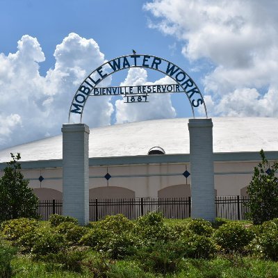
MAWSS (Mobile Area Wa... @MAWSSOfficial
704 Followers 1K Following We are committed to providing safe #drinkingwater and wastewater services that protect our #health and the #environment. ☎️ (251) 694-3100
WaterkeepersAlabama @WaterkeepersA
2K Followers 2K Following Regional Entity of @Waterkeeper Alliance launched in 2018 to further connect and support #Waterkeeper groups on waters that flow through and across Alabama.
Derek Law @GIS_Bandit
6K Followers 1K Following Product Manager @Esri | Interests #GIS, #HealthGIS, #Maps, #DataViz Please find me on Bluesky and Mastodon as "GIS_Bandit" Comments are my own.
Alabama Public Health @ALPublicHealth
22K Followers 455 Following Promoting, protecting, and improving Alabama's health. Like & Retweet. Questions? Message us! Terms of Use: https://t.co/rotM6VAdM9
NWS Mobile @NWSMobile
68K Followers 727 Following Official X account for the National Weather Service in Mobile/Pensacola. Details: https://t.co/oNUqOhd5lG
Creekline Trails of O... @CreeklineOTown
61 Followers 54 Following a community-driven initiative to create hiking and biking pathways along Opelika’s creeks and roadways while enhancing and preserving its natural resources
Urban Turtle Project @UrbanTurtlePro
154 Followers 63 Following Documenting urban turtle populations in Alabama
EOchatBot @EOchatBot
717 Followers 526 Following A friendly neighborhood bot for #EOchat, from the #EarthObservation community! #SciComm
Health GIS Associatio... @iahgis
36 Followers 2 Following Make the world a healthy place by using geospatial technologies
#gischatbot @gischatbot
4K Followers 4K Following A friendly bot from the GIS community! Developers: @jeafreezy & @adiguntoba Killed by Twitter API. Now moved to Mastodon. Supported by @NickBearmanUK
CMTS @USCMTS
193 Followers 212 Following The CMTS is a Federal inter-departmental committee directed to coordinate Federal MTS Policy among 30+ agencies.
Steven Schultze @GEO_Schultze
911 Followers 1K Following Associate Prof @UofSouthAlabama | Climate Change | Agriculture | Viticulture/Wine | GIS | Certified Spin 🚴 Instructor | Tacos | Not necessarily in that order
AlabamaSchoolBoards @AlaSchoolBoards
7K Followers 2K Following Founded in 1949, the Alabama Association of School Boards develops excellent school board leaders through quality training, advocacy & services #alaschoolboards
USACE Mobile @USACEMobile
1K Followers 1K Following Official Twitter account of the U.S. Army Corps of Engineers, Mobile District. Retweets, Follows ≠ endorsement. #MobileDistrict #SAD #USACE #MobileDelivers
GIS Colorado @giscolorado
443 Followers 17 Following GIS Colorado is a non-profit organization represented by members of the GIS community throughout Colorado.
ArkansasGIS @ArkansasGIS
780 Followers 53 Following Promoting efficient development, maintenance, and distribution of Arkansas’ geographic information resources.
NOAA Digital Coast @NOAADigCoast
20K Followers 4K Following @NOAA Office for Coastal Management is a fed govt office working w/partners to provide data, tools & info. Verification: https://t.co/uWyZK12IPJ


