
UtahView @UTView
Joined November 2014-
Tweets109
-
Followers53
-
Following61
-
Likes60
Maps on the Hill 2024, state capitol building where Utah's geospatial professionals show their #remotesensing and #GIS work. Ellie McGinty, @cmcginty, and @dramsey0425 showed Utah as Art and distributed ed. materials from USGS and NASA. #Landsat #Sentinel2 @utahview @AmericaView


Would you like to learn how to use web technologies to develop web mapping applications? West VirginiaView recently completed an update to their Client-Side Web GIS course. Check it out, it is free! wvview.org/cswg.html #GIS #earthobservation #remotesensing

Lights, camera, action! @AmericaView has been selected to be featured in the 2023 @theAGU TV Film Series. The interviews have taken place and now we wait for the debut in just a few weeks at the conference. #remotesensing #earthobservation


Two new Utah as Art pieces from #Sentinel2 - 1) Bear Lake in the fall, 2023 showing northern #Utah #fallcolors, and 2) our newest national monument, Bears Ears and vicinity, located in southeastern #Utah. @AmericaView, @USGS, @esa, @NASAEarth


Lake Powell is disappearing. This #EarthEngine script merging and animating #Landsat 4-9 shows how the lake has waxed, but mostly waned over the years. @USGSLandsat, @NASAEarthData, @UTView, @AmericaView
Update of my Great Salt Lake time series of Landsat imagery to include 2022. Also an image pair of the historic high (1986) & low (2022), and a trend line of % surface area relative to 1986. #Utah #EarthEngine @USGSLandsat @CNRUSU @USU_WILD @GreatSaltLakeSP
A colleague, @Belmont4Utah asked me to generate a satellite image of the north arm of the Great Salt Lake superimposing the yellow text . He downloaded the GPS coordinates of the text string into his smart-watch and ran it. A 42 miles round trip in one day. 😬😬


#ICYMI, last week we tested your knowledge with Earth images from #Landsat 8. You can download a full Name the Landform activity on our #BallSTEM Outreach Materials page! ➡️: bit.ly/3Br5mdE 📷: NASA/USGS


8 scenes of LANDSAT ingested to HDDS for event 202108_Hurricane_Ida #Flood #Hurricane #Ida hddsexplorer.usgs.gov/criteria?event…


The origins of @AmericaView lie with the original @USGSLandsat @OHViewGeo OhioView project initiated in 1998. OhioView remains a strong part of the AV consortium to this day - some 23 years later! Check out the USGS whitepaper from '98: prd-wret.s3-us-west-2.amazonaws.com/assets/palladi…
We love it when our mission comes together! Both the #Landsat9 satellite and the #AtlasV rocket that will launch L9 into space this September have arrived at Vandenberg Space Force Base. #Landsat @USGSLandsat landsat.gsfc.nasa.gov/article/landsa…


LandsatLook 2.0 is now available! The new tool takes advantage of Landsat in the cloud and allows users to visualize images using different band combinations and common indices. Read more: ow.ly/9SeJ50FmW8C Use the tool: ow.ly/JaGs50FmW8D

The #Landsat 9 satellite has arrived at Vandenberg Space Force Base. Hats off to all our mission partners who helped get #Landsat9 to Vandenberg! Details: landsat.gsfc.nasa.gov/article/landsa…

UtahView, hosted by @USU_WILD @CNRUSU and member of @AmericaView, was selected by @davis_arts to display the #UtahAsArt map collection at @DavisConfCenter. These maps showcase @USGSLandsat and @esa Sentinel 2A satellite imagery to help further #EarthObservation education.


Thanks to Iceland’s Midnight Sun, Landsat was able to obtain two sun lit passes of the Fagradalsfjall volcano on the same day. These false color images (Bands 6,5,4) were acquired about 10 hours apart on Jun 1, 2021


New remote learning activities are now available from MIView using @Esri StoryMaps. Great Lakes Watershed and Water Quality targeted at community colleges, arcg.is/1KHGiL and Tools for Understanding the Earth designed for elementary schools, arcg.is/zXj0C.

Congrats to @NASAPersevere on a successful Mars landing! #DYK that #Landsat data has history of use as a control to identify extraterrestrial landforms? Identifying features on Mars is no exception. This location was used to study dune formations on Mars ow.ly/p8FL50DDXQX


New video from the @USGS on the @LadiesOfLandsat Watch and download the full video here: ow.ly/iK4N50DDTZW @USGSLandsat
Big props to partner @USGSLandsat for maintaining the free & open #Landsat archive and managing mission operations. #OpenData #CalibratedData #LongDataArchive #BetterTogether #loveLandsat

Big props to partner @USGSLandsat for maintaining the free & open #Landsat archive and managing mission operations. #OpenData #CalibratedData #LongDataArchive #BetterTogether #loveLandsat


Bilal Liaqat @bilqat
413 Followers 1K Following A lawyer by choice, Computer Master, A True Patriot, Faisalabad, Pakistan
myhai2013 @Bondrea1984
202 Followers 1K Following
Regional Application ... @RACLafayette
61 Followers 517 Following RAC gathers and shares #satellite and #remotesensing #imagery for #GIS research #RACEarthasArt @LouisianaView Lead #AmericaView
Hannah Kinslee @Hannah41807
0 Followers 19 Following
Tom Dilts @TomDilts1
199 Followers 533 Following Father, outdoor lover, and landscape ecologist #HabitatConnectivity #LandscapeEcology #Conservation #RemoteSensing #SpeciesDistributionModel
lihui cui @CuiLihui
184 Followers 7K Following
TennesseeView @TennesseeView
68 Followers 44 Following Geospatial Education, Outreach, and Research in Tennessee | An @AmericaView member | Account managed by Qiusheng Wu @giswqs
TRANE78 @Takdikenal78
119 Followers 5K Following
ARCHIVED - NASA Lands... @NASA_Landsat
78K Followers 437 Following We’ve moved! Visit https://t.co/ObKiWKvAMz or follow @NASAEarth & @NASAGoddard for future Landsat updates.

Ken Boykin @kgboykin
241 Followers 1K Following 👨👩👧👦 🚲 🏄♀️ retired has-been🦎🏔️🌲🌴🦜 “Don’t skim your story” - Jake Boykin
Rachel Budge @RH_Budge
79 Followers 531 Following Avian Ecology Research Coordinator| grad student | Inclusion in STEM | Shorebird nest success | Passerine Populations | Geospatial Tech | Cello
Ladies of Landsat @LadiesOfLandsat
11K Followers 5K Following ALL are welcome! | #STEMinism | We 💜 @SistersofSAR, @WomenofWaves & @DamesofDrones! | Website coming soon!
ChesapeakeView @Chesapeake_View
61 Followers 243 Following ChesapeakeView focuses on public domain remotely sensed data & technologies in support of applied research, K-16 education, & workforce development
USGS Landsat @USGSLandsat
37K Followers 219 Following The Landsat Program is a series of Earth-observing satellites, co-managed by @USGS and @NASA. Delivering decades of Earth imagery, since 1972. 📡🛰️
Qiusheng Wu @giswqs
46K Followers 4K Following Associate Professor @UTKGeography | @Amazon Scholar | Talk about #opensource #geospatial #dataviz #EarthEngine
Amelakachen ** @yedeneknig
32 Followers 363 Following

Dr. Kate Fickas @katefickas
5K Followers 5K Following @Esri Director of Imagery & Remote Sensing Solutions 🛰️🌍| Space Science Diplomat @StateDept 🚀| @LadiesOfLandsat Founder 💪🏻| @USGS Mendenhall Fellow 🌦️📈
Hugo R. @HugoRCorderoS
239 Followers 320 Following Arquitecto de Soluciones - Tecnología - Software - Investigar - Geografía - Historia - Enseñar - Correr - Viajar - Escuchar música - Bicicletear - Fútbol
UASG 2021 @UASG7
504 Followers 2K Following Follow @uasg2023 for UASG2023 Twitter handle of International Conference on Uncrewed Aerial Systems in Geomatics handled by @vishalgeomatics STEM | SDGs
Michael Ahunanya @MichaelAhunany1
139 Followers 893 Following
COL (R) Pat Pascall @PascallPatrick
771 Followers 1K Following Senior Military Strategist, Author, SAMS, Navy War College, Army War College Graduate
AmericaView @AmericaView
509 Followers 207 Following A Nationwide Consortium for Remote Sensing Education, Research, and Geospatial Applications. - Empowering Earth Observation Education
LANDFIRE @nature_LANDFIRE
4K Followers 3K Following LANDFIRE | National geospatial layers | Vegetation models for all major systems in U.S. | Product support | Supports land management
R. Douglas Ramsey @dramsey0425
320 Followers 247 Following Professor @USU_WILD | #RemoteSensing | #Geospatial Science, #temporal analysis | #photographer | #woodworker | husband | father | grandfather
Rachel Sleeter @SleeterRachel
78 Followers 380 Following Geographer, @USGS Hydrologic Remote Sensing Branch https://t.co/vi3qczEFN7
Karin Kettenring @KarinKettenring
494 Followers 176 Following Professor of Wetland Ecology at Utah State University
Utah Water Watch @UtahWaterWatch
500 Followers 246 Following Volunteer Citizen Science Water Quality Monitoring in Utah. Helping protect lakes and streams!
Land Change Research @Land_Changes
858 Followers 3K Following This page provides news and results of global remote sensing research from groups at South Dakota State University and the University of Oklahoma.
Tommy Thompson @T0mmyTh0mps0n
24 Followers 92 Following
Hurricane City GIS @HurricaneUtGIS
102 Followers 238 Following Twitter account for the City of Hurricane GIS Department, Washington County, Utah.
Jessica Kirby @JessSummitCnty
102 Followers 127 Following Public Lands Manager for Summit County, Utah
New MexicoView @NewMexicoView
128 Followers 978 Following NMView is the New Mexico component of the AmericaView consortium. https://t.co/D3cjFMLnxw
OhioView @OHViewGeo
18 Followers 23 Following We are the statewide geospatial and remote sensing research and education consortium of Ohio. We're one of the many members of @AmericaView.
Utah Senate @utahsenate
35K Followers 14K Following The official Twitter account of the Utah Senate.
Esri User Conference @EsriUC
36K Followers 11K Following Join us for the world's largest GIS event, July 13-17, 2026! 🌎 #EsriUC2026
Fish Utah @Fishutah
88 Followers 167 Following Fishing Utah all year around. Carrot Stix Pro Staffer Billz Baitz Pro Staffer
Bradley Shellito @GeoBradShellito
94 Followers 120 Following Professor at Youngstown State University. Teaches GIS and remote sensing. Author of 'Discovering GIS and ArcGIS' and 'Introduction to Geospatial Technologies.'
Esri Blog @EsriBlog
10K Followers 4K Following Better Vision. Better World. The Esri Blog uncovers the many ways that GIS improves our world.
Jeff Ward @gEYEzer
152 Followers 292 Following family man, #GIS Coordinator, fly fishing, camping, small business owner, #USU grad, tweets are my own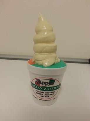
Zeppe's Italian Ice @Zeppes_Ice
85 Followers 874 Following Zeppe's italian water ice has the most amazing dessert in Utah. We are dedicated to making Italian Water Ice and Old Fashioned Frozen Custard.
GIS and Science @GISandScience
30K Followers 10K Following Sharing issues and applications of geospatial technology for scientific research and understanding. Tweets by the @Esri Science Team with @deepseadawn
H M @HarisMurshad
100 Followers 421 Following
GIS Day @gisday
28K Followers 9K Following Celebrate GIS Day on November 20, 2024! Show how GIS makes a difference in your community and in the world.
NASA History Office @NASAhistory
1.2M Followers 149 Following This is the NASA History Office's official X account. We're happy that you share our passion for aerospace history. Verification: https://t.co/6BaN3zUqRN
NASA @NASA
87.8M Followers 154 Following Official NASA account. Exploring the universe, advancing science, and inspiring the next generation of explorers. Verification: https://t.co/8nok3NP4PW
ChesapeakeView @Chesapeake_View
61 Followers 243 Following ChesapeakeView focuses on public domain remotely sensed data & technologies in support of applied research, K-16 education, & workforce development
Ladies of Landsat @LadiesOfLandsat
11K Followers 5K Following ALL are welcome! | #STEMinism | We 💜 @SistersofSAR, @WomenofWaves & @DamesofDrones! | Website coming soon!
Geospatial Profession... @URISA
10K Followers 3K Following The Geospatial Professional Network (formerly URISA) is a community of emerging and experienced GIS professionals.
New MexicoView @NewMexicoView
128 Followers 978 Following NMView is the New Mexico component of the AmericaView consortium. https://t.co/D3cjFMLnxw
LANDFIRE @nature_LANDFIRE
4K Followers 3K Following LANDFIRE | National geospatial layers | Vegetation models for all major systems in U.S. | Product support | Supports land management
Utah Avalanche Center @utavy_
23K Followers 37 Following Celebrating 43 years of keeping you on top of the greatest snow on earth®️
Hurricane City GIS @HurricaneUtGIS
102 Followers 238 Following Twitter account for the City of Hurricane GIS Department, Washington County, Utah.

Bern Szukalski @bernszukalski
5K Followers 216 Following GIS technical evangelist and geo advocate, product strategist. On a good day I'm making a map. On a great day I'm on one.
Life at TNC @nature_careers
3K Followers 203 Following Want to work for an organization you can believe in? The Nature Conservancy (@nature_org) is a leading conservation organization working for people and nature.
Evernote @evernote
383K Followers 15K Following 💚 Product: https://t.co/9huzrjQw2B 📚 Help: https://t.co/n8gSyRxQDx 📣 Forum: https://t.co/oxY1Azoghd 📩 DMs not monitored
Bradley Shellito @GeoBradShellito
94 Followers 120 Following Professor at Youngstown State University. Teaches GIS and remote sensing. Author of 'Discovering GIS and ArcGIS' and 'Introduction to Geospatial Technologies.'
Yellowstone National ... @YellowstoneNPS
1.1M Followers 426 Following The official feed of Yellowstone National Park.
UGRC Utah Geospatial ... @MapUtah
573 Followers 26 Following The Utah Geospatial Resource Center (UGRC) provides mapping technology services to federal, state, and local governments and other organizations.Utah SITLA GIS @SITLAGIS
20 Followers 17 Following Utah School and Institutional Trust Lands Administration (SITLA) GIS group.
Michael M. Foulger @MichaelAGRC
29 Followers 26 Following
Bert Granberg @SLCBert
272 Followers 96 Following
Scott Davis @SThomasDavis
439 Followers 319 Following Husband, Father, Latter-day Saint, Geospatial Web Developer working for the State of Utah UGRC (formerly known as AGRC). Had a GISP once. Opinions are my own.
Jessica Kirby @JessSummitCnty
102 Followers 127 Following Public Lands Manager for Summit County, Utah
Kevin Sato @ksato56
356 Followers 399 Following Retired from GIS since April 2019. Love sports - play hockey, golf - Coached competition soccer for 18 yrs. Hiking, traveling, travel, and photography is best
Kevin Bell @utahkev
54 Followers 32 Following GIS hack, urban farmer, dog petter, adventure rider, back country snowboarder, ninja.
STΞVΞ GOUΓLΞY (�... @steve_ugrc
443 Followers 141 Following he/him, gis software engineer, infrequent tweeter. follow me for current ugrc related gis information or random programming drivel.

Summit County GIS @SummitCountyGIS
79 Followers 1 Following
Google Maps @googlemaps
4.4M Followers 59 Following celebrating 20 years of exploring the world together 🎈
Utah Senate @utahsenate
35K Followers 14K Following The official Twitter account of the Utah Senate.
UtahDWR @UtahDWR
25K Followers 1K Following Utah Division of Wildlife Resources. Our mission is to serve the people of Utah as trustee and guardian of the state's wildlife.
Esri Blog @EsriBlog
10K Followers 4K Following Better Vision. Better World. The Esri Blog uncovers the many ways that GIS improves our world.
Envision Utah @envision_utah
3K Followers 578 Following What will Utah be like when our population doubles by 2050? Join us as we envision Your Utah | Your Future—because how we grow matters.

USGS Land Cover @USGSLandCover
10K Followers 756 Following This is an archived account and is not being updated. For the latest updates follow @USGS.
Esri User Conference @EsriUC
36K Followers 11K Following Join us for the world's largest GIS event, July 13-17, 2026! 🌎 #EsriUC2026
Peter Howe @peterdhowe
496 Followers 710 Following Geographer researching human responses to climate & environmental change. GIS/R/geovis/spatial analysis. Associate Professor at Utah State University.
GIS Day @gisday
28K Followers 9K Following Celebrate GIS Day on November 20, 2024! Show how GIS makes a difference in your community and in the world.
Mark Brunson @brunsonm2
591 Followers 486 Following Human-environment systems scientist working in deserts and rangelands. Fan of complexity, puzzles (scientific or otherwise) and the amazing world of plants.
Esri Conservation @Esri_Conserv
20K Followers 9K Following Official Twitter account of the Esri Conservation Team. Sharing the exemplary work of the global conservation community leveraging ArcGIS to save our planet.
USDA Forest Service @forestservice
181K Followers 2K Following The Forest Service manages public lands based on the greatest good for the greatest number in the long run. Following/likes/RTs don't = endorsement.
What is GIS? @GISdotcom
23K Followers 15K Following GIS lets us visualize, question, analyze, interpret, & understand data to reveal relationships, patterns, & trends.
Tyler Erickson @tylerickson
2K Followers 1K Following Sustainability & Climate Change | Geospatial Cloud Computing | Data Science & Analytics | Python | Jupyter | Bikes... https://t.co/KCRz6scA6O
GIS and Science @GISandScience
30K Followers 10K Following Sharing issues and applications of geospatial technology for scientific research and understanding. Tweets by the @Esri Science Team with @deepseadawn

Spatial Media - GeoTe... @SpatialCORE
33K Followers 3K Following Addressing developments in geospatial technology, online learning and more. We support media that occupies a place.US Department of the ... @Interior
4.9M Followers 111K Following Stewarding Conservation and Powering Our Future. For News and Policy: @InteriorPress47.

Esri @Esri
190K Followers 66K Following Esri builds #ArcGIS, the leading location intelligence and spatial analytics software for mapping, 3D GIS, imagery, and geospatial app development.
The National Map @USGSTNM
8K Followers 127 Following This is an archived account and is not being updated. For the latest updates follow @USGS.Trends for United States
You might like

