DAT/EM Systems @datemsystems
Developers of digital photogrammetric mapping systems datem.com Anchorage, Alaska Joined June 2009-
Tweets614
-
Followers359
-
Following270
-
Likes175
Join us at @GeoWeekExpo, February 13-15 in Denver. DAT/EM will be in booth 531. Stop by and see what we're up to.


Come visit with DAT/EM and Aerowest next week. We can't wait to see you and show off what we've been working on.
Has your Department of Transportation announced an upgrade to Bentley MicroStation CONNECT or ORD? No problem, DAT/EM is ready to help you upgrade, too. Capture and MapEditor for CONNECT/ORD is available for users who have active support. Contact DAT/EM Support today for details.
DAT/EM systems are created with intention. We aim to provide the best user experience possible by considering each and every updating suggestion. This way, we can be sure that our software meets, and even exceeds the expectations of our client base.


mia @neonsky_mia
101 Followers 1K Following Born in the cold, but my DMs stay warm 🔥❄️ Alaska raised with a wild heart and zero chill, literally. Slide in while it’s still FREE👇
Icreluh @Icreluh1585422
11 Followers 1K Following
𝐒𝐨𝐩𝐡𝐲 @Sophy_RaysX_
50 Followers 1K Following Alaska's cold but I'm burning hot🔥 Always up for funsies, catch me on my free link below ⬇️😉
Efraín Padilla (Repz... @Repzeta
31 Followers 420 Following
World Lidar Day @lidarday
17 Followers 69 Following
Nionit @NionitYoPDMxh
56 Followers 5K Following
SILVER SHADOW @BurakKorgan
57 Followers 1K Following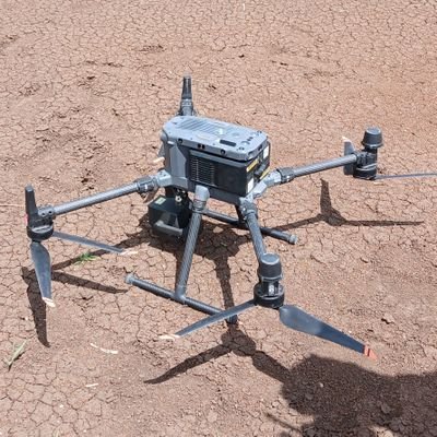
BATELEUR EAGLE @EtunyJob
292 Followers 2K Following photogrammetry and remote sensing gis Rugby,football lover. #BESUWIGO.
#gischatbot @gischatbot
4K Followers 4K Following A friendly bot from the GIS community! Developers: @jeafreezy & @adiguntoba Killed by Twitter API. Now moved to Mastodon. Supported by @NickBearmanUK
Sunny @Sunny39303585
11 Followers 190 Following
Ahsanuddin Ahamed @ahsaniverse
5 Followers 243 Following
Geosun Navigation @GeosunNav
1K Followers 4K Following Make the LiDAR/SLAM solution more affordable and applicable.
Monica Du @MonicaDu19
5 Followers 37 Following Business development at eSurvey GNSS, part of Unistrong. Contact me at [email protected]
regiser @Iamregiser
48 Followers 3K Following
César VHE @batidillohotma1
98 Followers 2K Following Maestro en Análisis espacial y Geoinformática Especialista en Geomatica Arqueologo Ciclista Dronero Baloncesto
Shane Armstrong @SGAVC2021
746 Followers 5K Following
Prof Abdul Qadir Bhat... @qadir_prof
420 Followers 7K Following Professor Department of Civil Engineering, Faculty of Engineering, Islamic University Madinah. Former Fulbright Visiting Professor at UC Berkeley.
Mohammad Al Khatib @khatibma
102 Followers 516 Following

Gerald @GBDISRUPT
291 Followers 2K Following Technologist's with a single focus to continue to drive technology to its outer boundaries. Ai, ML, IoT, LiDAR & Physical Security.
Leno1970 @Leno1970_INT
63 Followers 2K Following Tweeting in own name & RT's are not necessary endorsements
Pâmylla Carvalho @PamyllaCarvalho
13 Followers 168 Following Quixotesca, obstinada,curiosa, excêntrica,instável e totalmente contra bazofiadores.Diria que na melhor das hipóteses teimosa,legítima e terrivelmente amorosa.
𝕍𝕚𝕔 𝔻𝕚... @Altervic
278 Followers 1K Following Hola me llamo Manuel. “Paramédico 🚑 | Protección Civil 🛡️ | Gamer 🎮 | Coldplayer ❄️ | Amante de lo oscuro y Halloween 🎃”.
wz_dk_123 @wz_dk_123
27 Followers 1K Following
Intel @intel_reed
806 Followers 5K Following
David K. Eastham @dk_eastham
93 Followers 2K Following
AliRad - .گاهن... @AliRad_official
119 Followers 1K Following PhD in Lidar and photogrametric data processing & 💘 The UAV And Laser Scanner. Kickboxing, MuayThai and Self-defense coach.
Adam Belmonte @ajb474
56 Followers 289 Following Advocate for practical science, recovering PhD student, and avid sky watcher.


Synergy Mapping Inc. @SynergyMapping
3 Followers 9 Following Synergy Mapping, Inc. is a Colorado based aerial mapping firm that serves clients throughout the United States.
Alex Patricio Alarcó... @AlarconM_Alex
300 Followers 806 Following Máster en Gestión de Emergencias & Riesgo de Desastres 🌎 Ingeniero, Bombero de Aeropuerto Rescue & Firefighting Servicie RFFS #DGAC 🇨🇱
satee @satee26
19 Followers 753 Following
Khalil Djarane 19 @Khalil19Dj
304 Followers 1K Following Environnement Urbain et industriel, Wilaya de Sétif, Aménagement des Territoires, Valorisation et Recyclage des Déchets ... 🌴~🔍~🌴~💡~🌴
Geomni Aerial Imagery @GeomniMapPros
507 Followers 2K Following Geomni- Imagery and data for mapping professionals. #GIS #geospatial #lidar #mapping .
Alex @spatialhast
440 Followers 4K Following
Mike Jenkin @ShutterCG
97 Followers 170 Following Writer, Editor, Analyst. Enjoyer of computer things.
GeoDATA Forum @GeoDataForum
262 Followers 1K Following GeoDATA Forum is now part of GEO Business, next taking place on 5-6 June 2024. Please follow @GEOBusinessShow to keep up-to-date with show news.
MAGPIE-ROBIN 🇧🇩 @MagpieRobinBD
6 Followers 40 Following Leading Mapping and Photogrammetry company in Bangladesh
GeospatialNews @GeospatialNews1
409 Followers 1K Following
JE Tomes @TomesJe
421 Followers 2K Following JE Tomes is a manufacturer of packaged concrete restoration products, specializing in structural repair products, facade repair products and shotcrete products.

Miguel Vera @EagerVera
576 Followers 5K Following GEOINT | OSINT | S&R | Analista de Datos, Due Diligence.
Vexcel Imaging @vexcel_imaging
778 Followers 51 Following Vexcel Imaging is a global leader in aerial imaging, known for developing cutting-edge aerial cameras, mapping systems, and photogrammetric processing software.
Geospatial Stuff @GeospatialStuff
5K Followers 5K Following We tweet everything Geospatial related including GIS, geomatics, drones, open data, location technology, maps & much more
JG_RS_GIS @jg_rs_gis
132 Followers 778 Following All things Remote Sensing and Geographic Information Science 🛰️📡🛩️🤖 Currently working with Remote Sensing @OrdnanceSurvey All views are my own.INDEMAR @Indemarsurvey
2K Followers 4K Following INDEMAR Coastal Engineering is a company that offers marine construction, underwater inspection, oceanographic and geophysical surveys throughout the Caribbean.
GeoSpatial Next @geospatial_next
1K Followers 976 Following Trends, Insights & Network for Geospatial Community
#gischatbot @gischatbot
4K Followers 4K Following A friendly bot from the GIS community! Developers: @jeafreezy & @adiguntoba Killed by Twitter API. Now moved to Mastodon. Supported by @NickBearmanUK
Marco Polo @MarcoPoloMaps
198K Followers 781 Following Educational cryptography! Charting the uncharted territories of the crypto world and mapping out the future of finance. 🌍💰
🥔🗺️ ᴘᴏᴋ... @pokateo_maps
28K Followers 3K Following po-KATE-o, first of her name, eater of potatoes 🥔 and maker of maps 🗺️. I make GIS (more) fun by sharing maptastic themes & original mappy memes! 🌐 ᵛᶦᵉʷˢᵐᶦⁿᵉ
UneeQ @UneeQAI
2K Followers 3K Following Never practice on your prospects again with UneeQ Sales Trainer – AI roleplay for quota-crushing sales teams 💁♀️
Vexcel Imaging @vexcel_imaging
778 Followers 51 Following Vexcel Imaging is a global leader in aerial imaging, known for developing cutting-edge aerial cameras, mapping systems, and photogrammetric processing software.
southpaw @southpaw_aa
2 Followers 8 Following
NVIDIA Europe @NVIDIAEU
7K Followers 178 Following Official handle for NVIDIA Europe, the Middle East & Africa. Get the latest on @NVIDIA solutions for enterprises. See more on our blog: https://t.co/mjl3BsGQTP
Anand Iyer @anandfirouzeh
5 Followers 39 Following
GIS Resources @GISResources
2K Followers 640 Following GIS Resources is global platform for geospatial latest news & insights, developments, jobs, webinars, articles, data, conferences and tenders.
Kevin Redmond @KevKredmond
39 Followers 126 Following Inside Grand Central Station, New York Recreational Runner
Drew Meren @DrewMeren
151 Followers 267 Following Account Manager bringing geospatial data services to clients worldwide. Expert on visualizing content. Known foodie & man about town. Tweets my own.
Drone Analyst @droneanalyst
40K Followers 1K Following Your trusted partner in navigating the young drone market and determining what is new market hype versus market reality. Run by @Dave_Beno
SPAR Events @SPAR_Events
2K Followers 424 Following Now part of Geo Week! Organizer of conferences for professionals involved in end-to-end 3D imaging technologies.
NyCalKid @NyCalKid
9K Followers 12K Following Focused on business operations + commercial, industrial, educational + scientific uses for this evolving new #Drones Tech -FAA 333 #14381 + Cert Night UAS Pilot
Spatial Logic @spatial_logic
28 Followers 171 Following GIS and Geospatial Consulting services in Calgary, Canada. Offering cartography, spatial data, 2D and 3D visualization.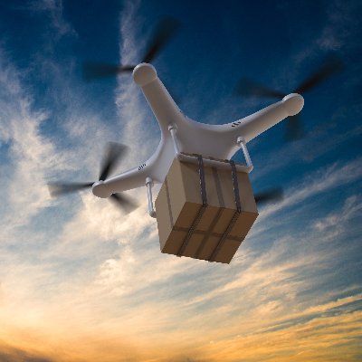
Drones and IoT @Drones_IoT
926 Followers 25 Following Focused on #Drones #UAV #UAS for #Military and Commercial markets including #IoT integration and #IndustrialAutomation
SOAR Oregon @SOAROregon
839 Followers 1K Following Oregon's Unmanned Aerial Systems Industry Advocate #SiliconSky ------------ --Signup for our monthly newsletter -- https://t.co/u30oRtbQBc
Ruben Cifrian @toviasproject
1K Followers 208 Following Geomatic engineer #topografia #laserscanning #photogrammetry #GIS #3dscanning #pointcloud #geomatica #cartografia #fotogrametria #SIG #BIM #ScanToBIM
Nature Hills Nursery @naturehills
33K Followers 18K Following 🇺🇸America's largest online plant nursery! 🌱 Want to have the best garden on the block? Read our blog for all of our #ProPlantTips! 🏡 #plantnursery
GeoSys.org @ HK @geosys_org
167 Followers 364 Following http://t.co/jdiGjcDggJ {GIS,RemoteSensing,Indoor Navigation,LiDAR,Sensors,MMS,3D Mapping,WebMapping,OpenGeo,BIM,360°,UAS}
Prague CVB @PragueConBureau
2K Followers 2K Following Official X (Twitter) account of Prague CVB is currently inactive, please follow us on other so-me accounts for #Prague updates. #PragueInSpires #eventprofs


GEOXITE @GeoXite
10K Followers 6K Following Desarrollo, consultoría y capacitación GIS (SIG) // Primeros en Chile en ser Esri Partner Silver Network y únicos premiados como Mejor Partner.
Food Bank of Alaska @FoodBankofAK
1K Followers 211 Following We're committed to ending hunger in Alaska by supplying food to partner agencies. Join us! Donate. Volunteer. Advocate. #FeedingAlaska
GivingTuesday @GivingTuesday
83K Followers 3K Following Transforming the world through radical generosity. 🫶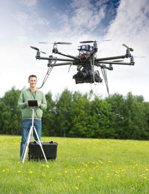
DronePilotClass @DronePilotClass
2K Followers 1K Following To Buy or Partner with http://t.co/NWa7083o94 #DRONEPILOTCLASS


Esri in the Middle Ea... @EsriMEA
1K Followers 438 Following Esri users create maps that run the world. #ArcGIS is an open platform for #GIS #Maps #3D #Imagery #AR #VR #Data #Analytics #DataViz #BigData #TheScienceofWhere
DroneLabs @DroneIndustries
9K Followers 5K Following It's Maritime Heritage Week. Sharing very large files online? DroneLabs is the easiest way to manage, send & share very large images with your visitors.
Geospatial Solutions @GSS_NCM
2K Followers 387 Following
Carlson Software @CarlsonSoftware
2K Followers 906 Following Founded in 1983, Carlson Software Inc. specializes in CAD design software, field data collection, laser measurement, mining, and machine control products.
Peggy March🫐🌎�... @RebelGeo
2K Followers 2K Following GEOConnector, Geographer, #GIS Pioneer, Fellow Royal Canadian Geographical Society, #geospatial @[email protected] @[email protected]

The GPS Group @thegpsgroup
396 Followers 870 Following Bringing clarity to #imaging & #orthorectifiation requirements of the #UAS #UAVs, #Drone community, providing image processing services. [email protected]Esri NortheastAfrica @EsriNeA
745 Followers 8 Following Esri Northeast Africa (Esri NeA) is the leading GIS professional services and solutions provider in the Middle East and Africa. We are ISO and CMMI certified.
Esri Chile @EsriChile
2K Followers 2K Following Vislumbrando un futuro mejor mediante el uso de la tecnología geoespacial 🌎 💫 #TheScienceOfWhere
GEOSYSTEMS France @GEOSYSTEMS_FR
1K Followers 4K Following Expert reconnu des services numériques exploitant la puissance de l’information géographique depuis 2006. Télédétection, FOUILLES 3D, Capture 3D, SIG
Esri Eastern Africa @EsriEA
9K Followers 3K Following A professional geospatial solutions company which inspires, educates and enables our customers with working GIS solutions.
josephkerski @josephkerski
14K Followers 2K Following Geography, geo-geekiness, STEM, ed tech, space, place, geographic information systems (GIS), GPS, outdoor education 365 days a year.
Eloqua @eloqua
13K Followers 3K Following We have moved! From now on you can follow us @OracleMktgCloud
GIS Hosting Services @mapserverpro
5K Followers 3K Following Open Source GIS Hosting Services #mapserver #geoserver #qgis #pmapper #geonode #openlayers #geomoose #geonetwork #openlayers #gis #geospatial #geomatics #foss4
Best Life Global @BestLifeGlobal_
73K Followers 26K Following We help business leaders improve performance at work and well-being in life.

RDC for Alaska @rdcalaska
4K Followers 352 Following The Resource Development Council for Alaska (RDC)-Growing Alaska through responsible resource development: oil and gas, mining, fisheries, timber, and tourism.
Alaska Chamber @alaskachamber
4K Followers 290 Following The leading voice advancing business in Alaska.
Shannon White @shannonhwhite
1K Followers 690 Following Education, Geospatial technology, GIS, GPS, RS, Drones, UAS, UAV, geography, Instructional Technology, geoinnovations, geocollaborations, Opinions are my ownTrends for United States
You might like