
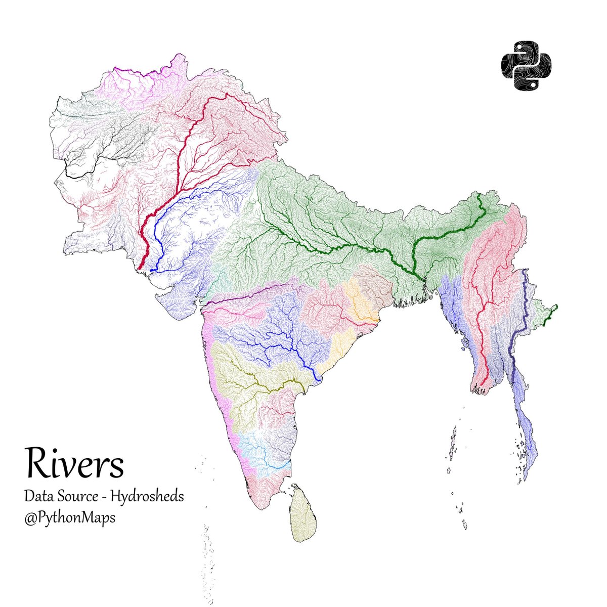
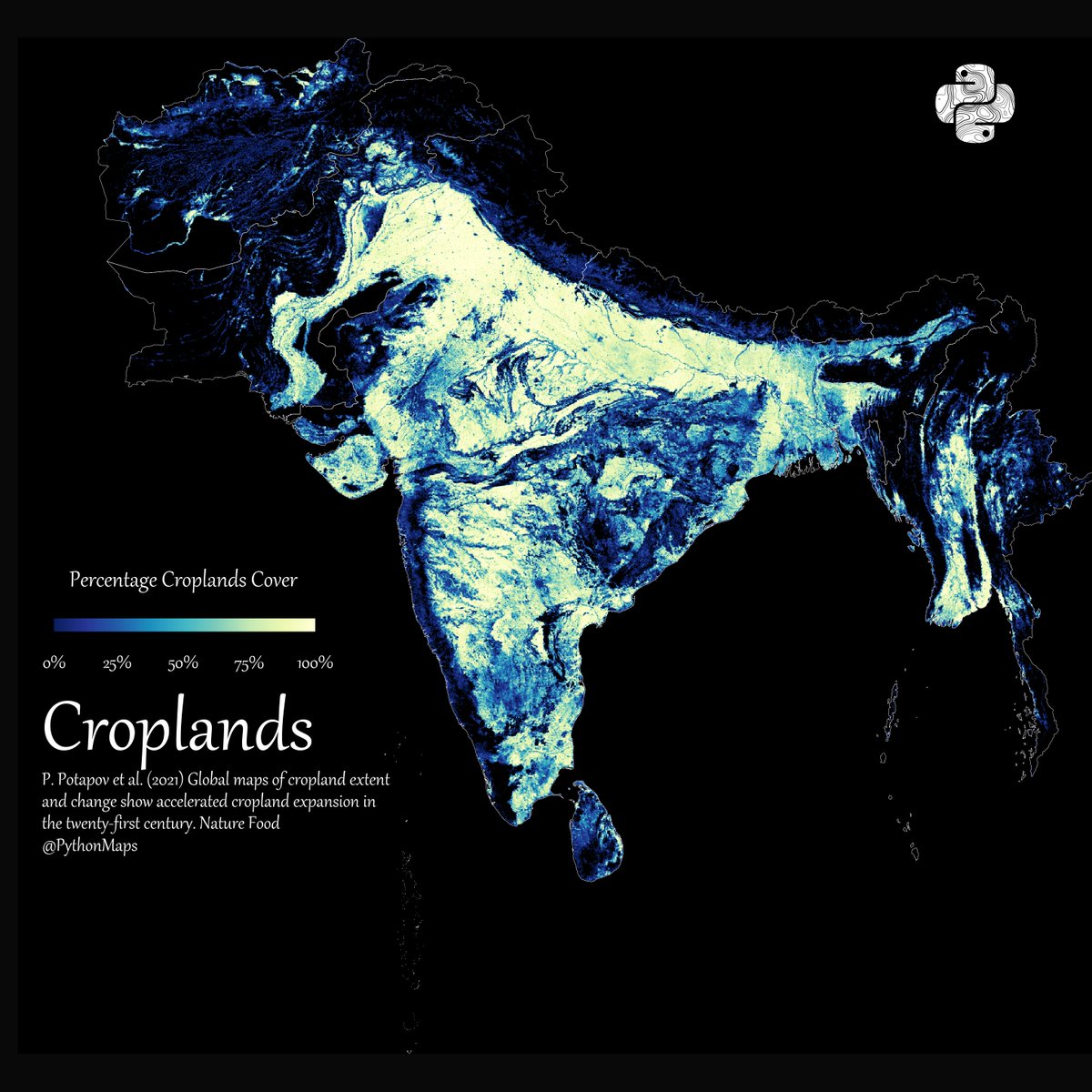
Another thread of maps I like. This time we are looking loosely at the Indian sub continent. Included are India, Pakistan, Afghanistan, Nepal, Bhutan, Bangladesh, Sri Lanka and Myanmar. First up, Rivers! 1/13
146
1K
11K
1.6M
5K
Download Image
Population - using data from @KonturInc 2/13

Forests - using everyones favourite colourmap. 😉3/13

Grasslands. Data comes from Global Land Cover-SHARE (GLC-SHARE) database. 4/13


@PythonMaps aren't the colours kinda reversed? I intuitively thought the higher the green, the higher the green cover

@PythonMaps Why does Bangladesh clearly lights up here?